
What is recorded here
Internal diam. c. 40m. A circular area surrounded by a substantial earthen bank up to 2m high in some places. The bank appears to have been made higher on the W side deliberately, possibly against the wind. In recent times the interior has been interfered with. The foundations of a straw rick are cut into the bank at the NW quadrant. The central part of the interior appears to be slightly raised but the rest is wet and overgrown with rushes. The 'fort' is situated in good land on the summit of a drumlin overlooking Donegal Bay but the surrounding valleys are boggy. The above description was derived from the 'Archaeological Survey of County Donegal. A description of the field antiquities of the County from the Mesolithic Period to the 17th century.' Compiled by: Brian Lacey with Eamon Cody, Claire Cotter, Judy Cuppage, Noel Dunne, Vincent Hurley, Celie O'Rahilly, Paul Walsh and Seán Ó Nualláin (Lifford: Donegal County Council, 1983).
Internal diam. c. 40m. A circular area surrounded by a substantial earthen bank up to 2m high in some places. The bank appears to have been made higher on the W side deliberately, possibly against the wind. In recent times the interior has been interfered with. The foundations of a straw rick are cut into the bank at the NW quadrant. The central part of the interior appears to be slightly raised but the rest is…
From the National Monuments Service (Archaeological Survey of Ireland) record DG094-016
The monument record does not grant public access. Check the route and ask the landowner before entering private land.
- What survives
- Recorded monument
Places near here
Photo credits
- National Inventory of Architectural Heritage
- Thielfer, Wikimedia Commons · CC BY-SA 4.0
- louise price, Wikimedia Commons · CC BY-SA 2.0
- Benson Wills, Wikimedia Commons · CC BY-SA 2.0
- Gerald England, Geograph · CC BY-SA 2.0
- Stephan van Helden, Wikimedia Commons · CC BY-SA 4.0
- Becky McReynolds, Wikimedia Commons · CC BY-SA 4.0
- Kenneth Allen, Geograph · CC BY-SA 2.0
- Andreas F. Borchert, Wikimedia Commons · CC BY-SA 4.0
- Ronnie Nijboer, Wikimedia Commons · CC0
- David Dixon, Geograph · CC BY-SA 2.0
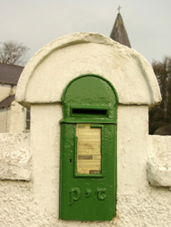 post box780 yd
 St. Mary's Catholic ChurchChurch/chapel · 800 yd
 Donegal Railway Heritage CentreMuseum · 1282 yd
 Donegal CastleCastle, tower house · 1584 yd
 Four Masters MemorialMemorial · 1714 yd
 DonegalHistoric town · 1735 yd
 Horse-chestnut1.1 mi
 Donegal Friary GraveyardGraveyard · 1.3 mi
 Killymard ChurchStone head · 1.3 mi
 Siege of DonegalSiege · 1.3 mi
 Wych Elm2.0 mi
 Ballyboyle IslandIslet · 2.5 mi
More archaeology and monuments in County Donegal · All of County Donegal
What do you know about this place?