
More pictures of this place


What is recorded here
Places near here
Photo credits
- National Inventory of Architectural Heritage
- Eric Jones, Geograph · CC BY-SA 2.0
- Kenneth Allen, Wikimedia Commons · CC BY-SA 2.0
- Tawg, Wikimedia Commons · CC BY-SA 3.0
- Kmcnamee, Wikimedia Commons · CC BY-SA 4.0
- Maker not stated on source page, ca.pinterest.com
- Maker not stated on source page, www.pinterest.com
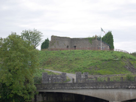 Belleek Battery / FortBattery and garrison fort · 116 yd
Explorer Tom Belleek Battery / Fort was raised right after the 1798 rebellion to guard the crucial bridge at Cloghgore. It’s now a…
 Belleek Pottery MuseumMuseum · 230 yd
Explorer Tom Belleek Pottery Museum is the place to discover that a teacup can have a more dramatic family history than half the…
 Belleek PotteryHeritage attraction · 256 yd
Explorer Tom Belleek Pottery in County Fermanagh is writing its dating profile right now: 'I make pretty blue things, I’m slightly…
 Battle of BelleekBattle · 439 yd
Explorer Tom Battle of Belleek, also called the Battle of the Erne Fords, took place at a River Erne crossing near Belleek on 10…
 Páirc na hEirne, Erne Gaels, BelleekGAA ground · 1005 yd
 Tetunny GraveyardGraveyard · 1148 yd
Explorer Tom Tetunny Graveyard in County Donegal sounds like a name you’d invent for a pirate’s hideout. I bet the soil here tastes…
 Battlefield in Cloghore (carrickboy Ed),corlea (pettigo Ed)Battlefield · 1209 yd
Explorer Tom Battlefield in Cloghore, Corlea refuses to fall down because it is terrified that if it does, the cows will finally…
 Cliff Generating StationHydroelectric power station · 1299 yd
Explorer Tom Cliff Generating Station in Cloghore is such an austere Modernist block that Saint Patrick would have walked right past…
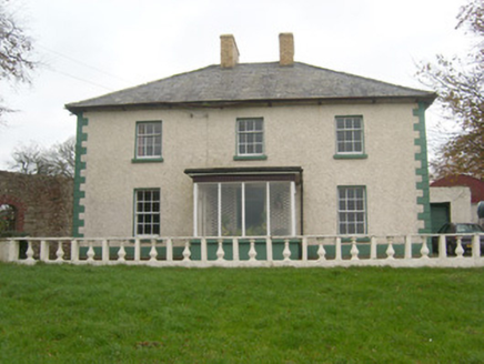 Rockfield HouseHouse · 1.1 mi
Explorer Tom Rockfield House in Knocknashangan hums a sad tune every time the wind blows through its sash windows, probably because…
 bridge1.1 mi
Explorer Tom Bridge in Corlea has two arches and a hump, with an almond-shaped cutwater dividing the Tullybaradaire River. I think…
 Rowantreehill HouseHouse · 1.3 mi
Explorer Tom Rowantreehill House has a weird little hole by the door. I bet it’s where they kept their secret snacks, or maybe just…
 Possible megalithic tomb: graveyard in KeenaghanPossible Megalithic Tomb: Graveyard · 1.6 mi
Explorer Tom Possible megalithic tomb: graveyard in Keenaghan is where the hero nobody remembers saved the day. He buried his fame…
More walking routes in County Donegal · All of County Donegal

What do you know about this place?Tap to add a comment or ask a question