What is recorded here
From OpenStreetMap (© OpenStreetMap contributors) n7820195010
Places near here
Photo credits
- National Inventory of Architectural Heritage
- Coffeecup2, Wikimedia Commons · CC BY-SA 4.0
- JP, Geograph · CC BY-SA 2.0
- Architecture of Dublin, Wikimedia Commons · Public domain
- Sitomon, Wikimedia Commons · CC BY-SA 2.0
- Olivier BEZES, Wikimedia Commons · CC BY 2.5
- Weston St. John Joyce, Wikimedia Commons · Public domain
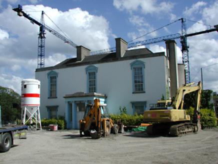 Bushy Park HouseCountry house · 247 yd
Explorer Tom Bushy Park House in Terenure is a lonely Georgian widow from the 1760s. It used to be a convent, now it’s empty. The bow windows are crying out for attention. Give it a shout!
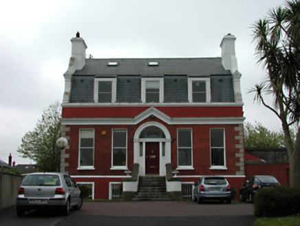 Butterfield HouseCountry house · 363 yd
Explorer Tom Butterfield House has a mansard roof with two attic storeys that looks totally wild. The contrasting wall finishes and robust entrance steps make it a distinctive office building that adds serious character to the busy road nearby.
 Enclosure in ButterfieldEnclosure · 587 yd
Explorer Tom Enclosure in Butterfield. Excavations found iron knives and a pig-shaped pin inside a palisade trench. Who needed a pig brooch on their tunic? It’s oddly specific for medieval fashion.
G. YardGraveyard · 798 ydExplorer Tom G. Yard. A pre-Norman grave-slab lies broken under an elder bush here. It’s a gentle, fragmented reminder of how old this place really is, hiding in plain sight.
 Rathfarnham CastleHouse, fortified house · 893 yd
Explorer Tom Rathfarnham Castle blends sixteenth-century fortification with later grandeur, its thick spine and flanker towers defying the Dublin Mountains.
 Austin Clarke BridgeMemorial · 1029 yd
Explorer Tom Austin Clarke Bridge in County Dublin is named after a poet who lived nearby, so cross it slowly and try to compose a verse about the river that doesn’t rhyme badly.
WhitecliffVisitor information · 1.1 miExplorer Tom Whitecliff in County Dublin sounds like a cliff. It’s actually just a visitor info spot, which is weirdly anticlimactic for such a dramatic and rocky-sounding name.
 Rathgar CastleCastle, unclassified · 1.3 mi
Explorer Tom Rathgar Castle once had walls so thick they held staircases inside, yet now only Beranger’s drawings remain to tell the tale.
 Éamonn CeanntMemorial · 1.7 mi
Explorer Tom Éamonn Ceannt in County Dublin led the Easter Rising and got executed at Kilmainham. A heavy hitter for a memorial spot. Give him some respect if you pass by his marker today.
 European Yew1.8 mi
Explorer Tom European Yew in County Dublin looks deadly serious. It's probably plotting something behind those dark needles. Don't let it see you crying over your coffee.
 Lebanon Cedar2.0 mi
Explorer Tom Lebanon Cedar in County Dublin is doing its best to look majestic. The photo shows a tree in Lebanon, so this one might be a copycat. Ask it for a discount on its beauty.
 Battle of RathminesMajor battlefield · 2.5 mi
Explorer Tom Battle of Rathmines in County Dublin is where the Royalists tried to attack Dublin but got a bit stuck on the hills. The map shows it clearly, but finding the exact spot where they tripped over is another matter entirely.
More things to do in County Dublin · All of County Dublin
What do you know about this place?Tap to add a comment or ask a question