What is recorded here
From the Irish Caves Database, University of Bristol Spelæological Society record 1857
Places near here
Picture notes
- Computer-made picture. It does not show this monument.
- Computer-made picture. It does not show this mountain top.
- Mike Searle, Wikimedia Commons · Creative Commons Attribution-ShareAlike 2.0
- Computer-made picture. It does not show this walking route.
- The Banner, Wikimedia Commons · CC BY-SA 3.0
- National Inventory of Architectural Heritage
- P L Chadwick, Geograph · Creative Commons Attribution-ShareAlike 2.0
- Mac McCarron, Geograph · CC BY-SA 2.0
 CairnCairn, unclassified · 457 ydComputer-made picture
Explorer Tom Cairn in Glencolumbkille North and Killeenmacoog South is a grassy lump with three kerbstones peeking out. It looks like it needs a haircut badly. Stand back, squint, and it looks like a very tired castle.
 Turloughmore MountainMountain / peak · 499 ydComputer-made picture
Explorer Tom Turloughmore Mountain, a rugged sentinel of County Clare, stands tall with a history as old as the hills themselves.
 Fulacht fia in Cappagh (burren By.)Fulacht fia · 603 ydComputer-made picture
Explorer Tom Fulacht fia in Cappagh is basically a stone horseshoe that forgot how to close its mouth properly. It sits by a spring, probably gossiping with the water all day long. Whisper a secret at it, it’s kept worse ones for centuries.
 Field boundary in BouleevinField boundary · 849 ydComputer-made picture
Explorer Tom Field boundary in Bouleevin just wants to be left alone on its hilltop. Bring your own legend, I've run out of them for this one, sorry.
 BarrowBarrow, unclassified · 1128 ydComputer-made picture
Explorer Tom Barrow in Glencolumbkille North looks like a bell that got squashed by a very angry cow. A wall runs right through the middle, which is rude. Toast it with a cuppa and move along, love.
_-_geograph.org.uk_-_4570444.jpg/250px-Castles_of_Munster,_Cappagh,_Clare_(1)_-_geograph.org.uk_-_4570444.jpg "Photo: Mike Searle, Wikimedia Commons · Creative Commons Attribution-ShareAlike 2.0") Cappagh CastleCastle · 1400 yd
Cappagh CastleCastle · 1400 ydExplorer Tom Cappagh Castle rises as a tall stone ruin in open rocky grassland, standing firm under the cloudy sky of County Clare.
 Slieve Carran/Keelhilla loop yellowWalking route · 1.5 miComputer-made picture
Explorer Tom Slieve Carran/Keelhilla loop yellow is doing that thing where it looks easy but isn't. Probably full of sheep with attitude. Don't let them bully you off the trail, mate.
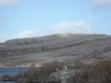 Burren National ParkNature reserve · 1.7 mi
Explorer Tom Burren National Park is a landscape like no other, with its rocky karst terrain stretching out under the wide, open sky of County Clare.
 Slieve Carran/Keelhilla loop redWalking route · 1.8 miComputer-made picture
Explorer Tom The Slieve Carran/Keelhilla loop red is screaming at you to walk it. I reckon the red means danger, or maybe just embarrassment. Keep your eyes peeled for anything suspiciously shiny.
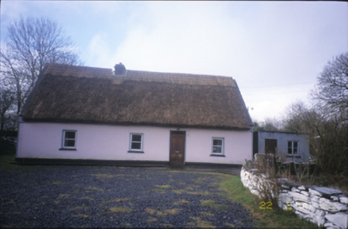 Tulla ParkFarm house · 2.2 mi
Explorer Tom Tulla Park is a thatched farmhouse that looks like it just stepped out of a cottage core Pinterest board. If it went to a chipper, it’d order extra gravy and a side of tradition. Go back in winter, it's a different animal.
 Saint Columba's Catholic ChurchChurch/chapel · 3.5 mi
Explorer Tom Saint Columba's Catholic Church in Crughwill is basically the village's living room, just with better lighting and more judgmental stares. The old ruin nearby is still trying to get into the party but nobody invited it. Hum something sad nearby; it adds atmosphere for the dramatics.
 Castle in ruinsCastle, tower house · 3.6 mi
Explorer Tom Castle in ruins near Carran Turlough is secretly proud of the potato growing next to its foundation because the castle is doing worse. It controls a routeway but mostly just controls your sense of direction. Pretend it's yours and plan the housewarming.
More caves in County Clare · All of County Clare

What do you know about this place?Tap to add a comment or ask a question