
What is recorded here
From OpenStreetMap (© OpenStreetMap contributors) n6365414027
Places near here
Photo credits
- Mike Searle, Wikimedia Commons · Creative Commons Attribution-ShareAlike 2.0
- Gordon Hatton, Geograph · Creative Commons Attribution-ShareAlike 2.0
- Mac McCarron, Geograph · Creative Commons Attribution-ShareAlike 2.0
- The Banner, Wikimedia Commons · CC BY-SA 3.0
- National Inventory of Architectural Heritage
- Robert Bone, Geograph · CC BY-SA 2.0
- Drow69, Wikimedia Commons · CC BY-SA 3.0
- Paul Woods, Wikimedia Commons · CC BY 2.0
- JuneGloom07, Wikimedia Commons · CC BY-SA 4.0
- Mike Searle, Wikimedia Commons · CC BY-SA 2.0
- John M, Geograph · CC BY-SA 2.0
Explorer Tom Kilnaloone Graveyard: an archaeological site where the dead rest in quiet, unmarked slumber
 Cappagh CastleCastle · 1.0 mi
Explorer Tom Cappagh Castle rises as a tall stone ruin in open rocky grassland, standing firm under the cloudy sky of County Clare.
 Holy Well1.1 mi
Explorer Tom Holy Well in Glencolumbkille South is walled in and fed by springs higher up the hill, so it’s basically a water park with an entry fee of humility. If it rains, blame me.
 Grave YardGraveyard · 1.2 mi
Explorer Tom Graveyard in Glencolumbkille South has a carved stone head hiding in the wall. Legend says if you don't wave, you get cursed with bad socks. A good place to forget your phone for ten minutes flat.
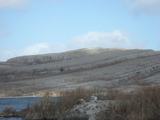 Burren National ParkNature reserve · 1.5 mi
Explorer Tom Burren National Park is a landscape like no other, with its rocky karst terrain stretching out under the wide, open sky of County Clare.
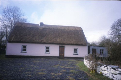 Tulla ParkFarm house · 2.2 mi
Explorer Tom Tulla Park is a thatched farmhouse that looks like it just stepped out of a cottage core Pinterest board. If it went to a chipper, it’d order extra gravy and a side of tradition. Go back in winter, it's a different animal.
 Slieve RoeMountain / peak · 2.6 mi
Explorer Tom Slieve Roe, a towering peak in County Clare that's as majestic as the landscape it commands.
 Templecronan (in ruins)Church · 2.8 mi
Explorer Tom Templecronan survived a storm that broke the local boatman’s back, and it just shrugged it off. The cyclopean masonry is thick enough to block out bad news. Stand there long enough and someone will ask if you're lost.
 Mullagh MoreMountain / peak · 3.0 mi
Explorer Tom Mullagh More, a limestone hill in County Clare that's as hardy as the people who live there.
 Father Ted's HouseHeritage attraction · 3.2 mi
Explorer Tom Father Ted's House is a nostalgic glimpse into Ireland's comedy heritage, with the exterior shots of the show preserved in County Clare.
 Cloondooan Castle (in ruins)Castle, tower house · 3.2 mi
Explorer Tom Cloondooan Castle in Rockvale sits on a rocky ridge like it’s waiting for someone to lose a bet there. It overlooks Lough Bunny, which sounds like a dog that hasn’t been bathed since 1900. Have a sandwich here and call it a heritage lunch.
 Kilmacduagh Monastic SiteVisitor information · 4.4 mi
More mountains and hills in County Clare · All of County Clare

What do you know about this place?Tap to add a comment or ask a question