
What is recorded here
From the National Monuments Service (Archaeological Survey of Ireland) record KE109-030
Places near here
Photo credits
- Maker not stated on source page, uk.pinterest.com
- Maker not stated on source page, commons.wikimedia.org
- Maker not stated on source page, www.pinterest.com
- Maker not stated on source page, ru.pinterest.com
- Trevor Harris, Geograph · CC BY-SA 2.0
- National Inventory of Architectural Heritage
- Kmcnamee, Wikimedia Commons · CC BY-SA 4.0
- Mike Dickison, Wikimedia Commons · CC BY 4.0
- Josh Jackson, Wikimedia Commons · CC BY 2.0
- Malcolm Neal, Wikimedia Commons
 Stone CircleStone circle, multiple-stone · 131 yd
Explorer Tom Stone Circle in Drombohilly Upper has strong opinions on modern buildings, specifically that they lack soul. Nine…
 Wedge tomb in Drombohilly UpperWedge tomb · 332 yd
Explorer Tom Wedge tomb in Drombohilly Upper has a roof stone that slopes like it's trying to slide off onto your head. It’s got an…
 Enclosure in Lehid (glanarought By.)Enclosure · 638 yd
Explorer Tom Enclosure in Lehid started because two lads bet on whether sheep could jump a specific rock. One won, the other lost…
 Standing stone in Lehid (glanarought By.)Standing stone · 740 yd
Explorer Tom This small Standing stone in Lehid has a grudge against the weather because it’s been getting wet for centuries without…
 Standing stone in Drombohilly UpperStanding stone · 969 yd
Explorer Tom Standing stone in Drombohilly Upper is invisible because the wind keeps picking on it and blowing it away. The official…
 KnockateeMountain / peak · 1.0 mi
Explorer Tom Knockatee in County Kerry has a very strong opinion that the road leading to it is an insult to its dignified standing…
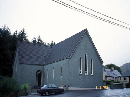 Saint Killian's Catholic ChurchChurch/chapel · 1.5 mi
Explorer Tom Saint Killian's Catholic Church in Derreen would complain to the council about the lack of parking for angels. It’s got…
 Tuosist GAA pitchGAA ground · 1.6 mi
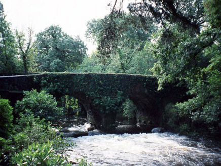 Lauragh BridgeBridge · 1.6 mi
Explorer Tom Lauragh Bridge was built by a giant who simply got bored of carrying rocks himself. He left a note saying he’d be back…
 New Zealand broadleaf1.8 mi
Explorer Tom New Zealand broadleaf in County Kerry handles nosey neighbours by simply growing faster than they can blink. It’s like…
 Soft Tree-fern1.8 mi
Explorer Tom Soft Tree-fern in County Kerry nearly got famous for being too soft to handle its own glory. It’s basically a fern that…
 Derreen GardensGarden · 1.8 mi
Explorer Tom Derreen Gardens has nearly twelve kilometres of paths, which is what happens when a family takes "let's put in a few…
More archaeology and monuments in County Kerry · All of County Kerry

What do you know about this place?Tap to add a comment or ask a question