
Places near here
Photo credits
- Trevor Harris, Geograph · CC BY-SA 2.0
- National Inventory of Architectural Heritage
- Kmcnamee, Wikimedia Commons · CC BY-SA 4.0
- Dr Charles Nelson, Geograph · CC BY-SA 2.0
- Mike Dickison, Wikimedia Commons · CC BY 4.0
- Josh Jackson, Wikimedia Commons · CC BY 2.0
- Yosemite, Wikimedia Commons · CC BY-SA 3.0
- Malcolm Neal, Wikimedia Commons
- Richard Webb, Wikimedia Commons · CC BY-SA 2.0
- Gordon Hatton, Geograph · CC BY-SA 2.0
 KnockateeMountain / peak · 1656 yd
Explorer Tom Knockatee in County Kerry has a very strong opinion that the road leading to it is an insult to its dignified standing…
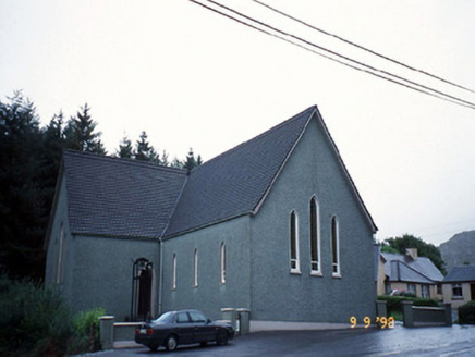 Saint Killian's Catholic ChurchChurch/chapel · 1.4 mi
Explorer Tom Saint Killian's Catholic Church in Derreen would complain to the council about the lack of parking for angels. It’s got…
 Tuosist GAA pitchGAA ground · 1.6 mi
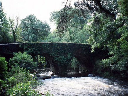 Lauragh BridgeBridge · 1.6 mi
Explorer Tom Lauragh Bridge was built by a giant who simply got bored of carrying rocks himself. He left a note saying he’d be back…
 Derreen HouseHouse · 1.7 mi
Explorer Tom Derreen House in Kerry had a first owner with an escape plan involving rhododendrons and tree ferns. Built around 1865…
 New Zealand broadleaf1.7 mi
Explorer Tom New Zealand broadleaf in County Kerry handles nosey neighbours by simply growing faster than they can blink. It’s like…
 Soft Tree-fern1.7 mi
Explorer Tom Soft Tree-fern in County Kerry nearly got famous for being too soft to handle its own glory. It’s basically a fern that…
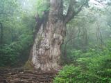 Japanese cedar1.7 mi
Explorer Tom A Japanese cedar in County Kerry claims it’s older than the hills, which is definitely a lie. But who wants to argue…
 Derreen GardensGarden · 1.7 mi
Explorer Tom Derreen Gardens has nearly twelve kilometres of paths, which is what happens when a family takes "let's put in a few…
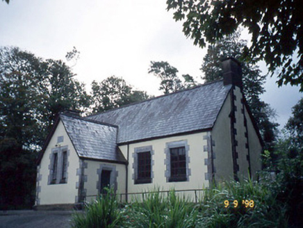 Lauragh National SchoolSchool · 1.9 mi
Explorer Tom Lauragh National School thinks tourists from Dublin are just children with better shoes and worse manners. It’s been…
 KnockastumpaMountain / peak · 2.6 mi
Explorer Tom Knockastumpa in County Kerry is home to one stubborn bird that absolutely refuses to leave, despite several offers of…
 Ormond's IslandIslet · 2.7 mi
Explorer Tom Ormond's Island brags about surviving a storm so huge it claimed the waves were actually giant whales trying to eat it.…
More archaeology and monuments in County Kerry · All of County Kerry

What do you know about this place?Tap to add a comment or ask a question