What is recorded here
At a cliff-edge on the summit of Tullaghan Hill, a prominent rocky peak that rises from a bog-covered plateau NE of Coolaney, in the Ox Mountains. The fort has excellent views and overlooks a mountain pass to NW. A roughly D-shaped area (21m E-W; 19m N-S) defined E-W by two concentric stone walls and on the straight N…
Read the whole record
From the National Monuments Service (Archaeological Survey of Ireland) record SL026-001001
Places near here
Photo credits
- National Inventory of Architectural Heritage
- Willow, Wikimedia Commons · CC BY 2.5
- GTD Aquitaine, Wikimedia Commons · Public domain
- Djedi Guy, Wikimedia Commons · CC BY-SA 4.0
- A.-K. D., Wikimedia Commons · CC0
- Andreas F. Borchert, Wikimedia Commons · CC BY-SA 4.0
Explorer Tom Tullaghan Hill in County Sligo nearly became famous for hosting a very bad karaoke night in the eighties. It’s still trying to shake off the embarrassment. Stand there long enough and someone will ask if you're lost.
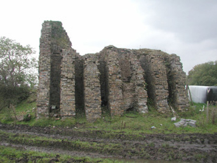 Coolaney Brick WorksKiln · 719 yd
Explorer Tom Coolaney Brick Works would be absolute gold on a reality show, mostly because it’s slowly collapsing into the earth while everyone argues about who broke the cast-iron fragments. It was once formidable but now it’s just rubble with ambition in Tullaghan, disintegrating at a pace that makes you worry for the foundations. Keep your footing steady and don’t wander off into the muck.
DoomoreMountain / peak · 1622 yd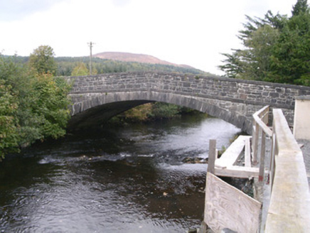 bridge1684 yd
Explorer Tom Bridge in Coolaney has made its New Year's resolution to stop cars from driving over it like it’s a speed bump. It’s an elegant stone beauty that just wants some respect and a good polish. Wave at its masonry as you pass through!
Moymlough Castle (in Ruins)Castle, tower house · 1.1 miExplorer Tom Moymlough Castle would describe the 1800s to a teenager as 'vibes were off but the stone was solid.' It’s missing half its walls, so it’s basically a skeleton with attitude problems. Take a breath of that air, it's older than your car.
 European ash3.5 mi
Explorer Tom European ash in County Sligo handles nosey neighbours by simply dropping a leaf directly on their heads every single time they look up. It’s a small act of defiance, but effective. Tell the kids it's a castle. Close enough.
 Battlefield in Carricknagat (leyny By.),rinn (leyny By.),bleachgreen,collooney,ardcottenBattlefield · 3.7 mi
Explorer Tom Battlefield in Carricknagat survived a massive storm by just staying put, which is impressive for a spot with such a chaotic history of conflict and confusion. It’s got a real 'I’ve seen it all' attitude that makes you feel like your problems are tiny in comparison to the old wars. Go at sunset and thank me later.
 Teeling MonumentMemorial · 3.7 mi
Explorer Tom The Teeling Monument refuses to fall down because it’s too proud to admit the ground beneath it is just soft mud. It stands there looking smug, like it owns the whole of Collooney and knows secrets it won’t share. Give it a pat on the way past, it's had a long life.
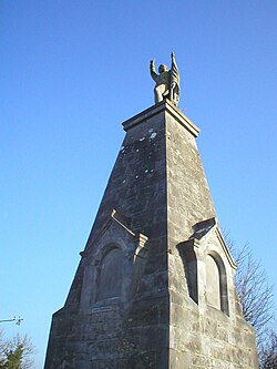 Battle of CollooneyBattle · 3.7 mi
Explorer Tom The Battle of Collooney in County Sligo took about four cups of tea to build up the energy needed for the fighting, and they used them all up. Bartholomew Teeling put up a monument there, which is basically a giant finger wagged at history for forgetting this little scuffle. Stop the car, it's worth the hazard lights.
 CrannogeCrannog · 4.9 mi
Explorer Tom Crannoge in Ballydawley is basically invisible now, which is hilarious because it used to be a massive stone mound in the lough. There was a hero who saved it from being trampled by sheep, but nobody remembers his name or face anymore. Have a look and decide if I was lying.
 ListoghilPassage tomb · 5.2 mi
Explorer Tom Listoghil in Carrowmore has an imaginary twin across the sea that sends it postcards with no return address, which is why it’s so confused right now. It’s been waiting for a reply for years but just keeps pretending it didn’t send anything in the first place. Bring someone who'll believe anything.
The Cailleach: CarrowmoreLegend location · 5.4 miExplorer Tom The Cailleach: Carrowmore is a field of ancient tombs with a woman in the stories powerful enough to shape the land around them. I can barely shift one big garden stone. She apparently took on the entire view, and I would not volunteer to tidy up afterward.
More archaeology and monuments in County Sligo · All of County Sligo

What do you know about this place?Tap to add a comment or ask a question