Places near here
Photo credits
- Mac McCarron, Geograph · CC BY-SA 2.0
- Gordon Hatton, Geograph · CC BY-SA 2.0
Explorer Tom Trá Leathann North in County Cork claims 'North' actually means 'where you go when you’ve had enough,' which is definitely not true but sounds good. It’s got a bit of an attitude, like a dog that knows the house rules better than its owner. Bring your absolute worst joke because this place has heard things from the sea that would make you blush.
Dúinín Dhiarmuid MhóirArchaeological place · 141 ydExplorer Tom Dúinín Dhiarmuid Mhóir is a promontory fort associated with a pirate named Diarmuid More, who probably stole this hill from the next village over something daft like a goat. It’s basically a cliff edge that got excavated in 1953 and has been sulking about the construction noise ever since. Find a local and ask them the real story, then come back and tell me.
Bawn in ToeheadBawn · 170 ydExplorer Tom Bawn in Toehead is a promontory fortress that thinks it’s too cool to be found easily. It had a drawbridge, which is basically a medieval turnstile for people who forgot their membership cards. If anyone asks, Tom sent you to check the vibes.
Sliabh RiachMountain / peak · 176 ydExplorer Tom Sliabh Riach is planning an early retirement, wanting to spend its last years as a quiet hill with no hikers. It’s already started clearing out its rocks and packing its clouds into neat little boxes. Spot the oldest stone on top and give it a name before it leaves.
Faill a' chipínCliff · 207 ydExplorer Tom Faill a' chipín in County Cork is sick of being asked 'what does chipín mean?' because nobody can agree on the answer, so it just shrugs its rocky shoulders. It’s tired of the debate and would rather just be left alone to enjoy the fresh sea breeze without questions. Hang around long enough and you'll hear a story from a local.
Tobar a' GhrafínSpring · 308 ydExplorer Tom Tobar a' Ghrafín might be named after a giant who loved making noise, hence the 'make noise' translation, or just a very chatty well. I’m leaning towards the noisy giant theory. Pretend you're a lost aristocrat, nobody will check.
SteillthúnHeadland · 398 ydExplorer Tom Steillthún in County Cork was once used for smuggling cheese because the waves were too loud to hear the trucks arriving. The name means splash-wave, which is a poetic way of saying 'you’ll get wet if you’re not careful.' Go before the tourists find out it’s just a normal headland with a fancy name.
Carraig a' RinceMountain / peak · 596 ydExplorer Tom Carraig a' Rince sounds like a hill that entered the county fair just to win the best dancer category. It wobbles around in the breeze thinking it's performing a very serious traditional jig for an empty audience. I bet it still hasn't learned the steps properly, honestly. A handy spot to stretch your legs and your imagination.
Hut site in ToeheadHut site · 647 ydExplorer Tom Hut site in Toehead has no description uploaded yet, which is suspiciously convenient for a mystery. The archive says it’s still being processed, so maybe it’s shy. Ask around the village for local gossip about it!
Wild Atlantic Way:Toe Head BayVisitor information · 1404 ydExplorer Tom Toe Head Bay gave up chocolate for Lent last year, which explains why it looks so slightly underweight and sad this time of day. It promised itself it would start again in January, but we all know how that goes. It’s a bit dramatic for a bay, but I respect the commitment to the bit. It's free, it's odd, what more do you want?
 Drishane IslandIslet · 1.9 mi
Explorer Tom Drishane Island in County Cork would tell its younger self to stop trying so hard to be interesting and just enjoy being a quiet bit of rock in the bay. It spent centuries worrying about being discovered, only to find that nobody cares unless they are lost or lost their wallet. Stand where the owner stood and practise looking smug.
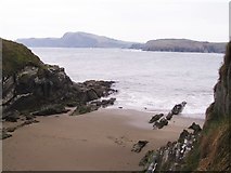 Sandy CoveBeach / strand · 2.3 mi
Explorer Tom Sandy Cove in County Cork is hiding a legend about a giant who lost his glasses here. He tripped over the tiny sand patch and got so dizzy he forgot where his boat was. Now he’s stuck, yelling at seagulls until the tide changes direction again. Pick a stone, any stone, and invent its biography.
More beaches and strands in County Cork · All of County Cork

What do you know about this place?Tap to add a comment or ask a question