What is recorded here
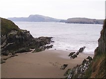
Dúinín translates to fort while Diarmuid More was a pirate. Promontory fort associated with Dermot Conor O’Driscoll (ref Fr Coombes). Fort excavated by Prof. O’Kelly, UCC, in 1953.
From OpenStreetMap (© OpenStreetMap contributors) w975209865
Places near here
Photo credits
- Mac McCarron, Geograph · CC BY-SA 2.0
- Gordon Hatton, Geograph · CC BY-SA 2.0
Bawn in ToeheadBawn · 40 ydTrá LeathannBeach / strand · 69 ydFaill a' chipínCliff · 87 ydSteillthúnHeadland · 266 ydSliabh RiachMountain / peak · 294 ydTobar a' GhrafínSpring · 417 ydCarraig a' RinceMountain / peak · 690 ydHut site in ToeheadHut site · 742 ydSt Bartholomews WellHoly well · 959 ydWild Atlantic Way:Toe Head BayVisitor information · 1545 yd Drishane IslandIslet · 1.9 miSandy CoveBeach / strand · 2.4 mi
 Drishane IslandIslet · 1.9 mi
 Sandy CoveBeach / strand · 2.4 mi
More archaeology and monuments in County Cork · All of County Cork
What do you know about this place?