DDiscover AloneMapAbout

Town defences in Kildare

Town defences
Computer-made picture that does not show Town defences in KildareNot a photo of this monument
Computer-made picture. It does not show this monument. · Report the wrong picture

The monument record does not grant public access. Check the route and ask the landowner before entering private land.

What do you know about this place?Tap to add a comment or ask a question

What you write will be public.

What is recorded here

According to Bradley et al. (1986 vol. 3, 213), a charter of 1515 authorised the burgesses of Kildare to enclose the town with a stone wall and a fosse, for which a murage grant was provided. Thomas (1992, 125) suggests that that grant, ‘… made a few years after the death of the “great earl” of Kildare but during the…

Read the whole record
According to Bradley et al. (1986 vol. 3, 213), a charter of 1515 authorised the burgesses of Kildare to enclose the town with a stone wall and a fosse, for which a murage grant was provided. Thomas (1992, 125) suggests that that grant, ‘… made a few years after the death of the “great earl” of Kildare but during the lord deputy-ship of his son, may therefore have been to restore an existing but decayed wall, or else to upgrade a simple earthen enclosure.’ While the existence of a murage grant is not proof positive that defences were either constructed or repaired at that date, Kildare’s frontier location strongly suggests that town defences were a necessity, unless the strong Anglo Norman castle (KD022-029004-) was deemed sufficient to meet any threat. No visible physical evidence for the morphology of the town defences survives, and any description is based on, mainly later, historical sources, and any suggested town wall course is conjectural. The earliest reference to town gates only occurs in the later-17th century, when, in 1674, three gates are mentioned; Clare Gate, Ellis Gate and White Gate, and a Fire Castle, which may also have formed part of the defences. The Clare Gate was situated on Claregate Street on the W side of the town (PRONI D 30378/2/3/5), and is indicated on Roque's 1757 map. Bradley et al’s mapping (op. cit. 213, Fig. 85) suggests a location at c. ITM E 672649 N 712438. Ellis Gate was probably located on Station Road, on the highest point of the ridge at the NE side of the town. Bradley et al.’s mapping (op. cit 214, Fig. 85) suggest a location at c. ITM E 672912 N 712480. White Gate was located on the E side of the town on Dublin Street, possibly just SSE of the Anglo Norman castle (KD022-029004-). Bradley et al.’s mapping (op. cit. 214-5, Fig. 85) suggests a location at c. ITM E 672953 N 712333. The Fire Castle is shown on Rocque’s 1757 map, to the W of the Cathedral (KD022-029005-) and may have formed part of the town defences. Bradley et al.’s mapping (op. cit. 213-4, Fig. 85) suggests a location at c. ITM E 672673 N 712536. It’s likely there was a S gate, possibly near the S end of Bride Street. Bradley et al.’s mapping (op. cit. 213-4, Fig. 85) suggests a location at c. ITM E 672809 N 712232. Besides the town gates, Rocque’s map records ‘Black Ditch or Cleamore Street’ as the old name for Academy Street, which suggests the town’s SW defences ran along this line, between Clare Gate at W and a S gate. Thereafter, the defences would have followed a line possibly running E from a S gate before turning N to the White Gate and on to the NNW to Ellis Gate, then, skirting N of the Cathedral, back around to the Clare Gate, via Fire Castle. (Andrews and Simms 1986; Horner 1975-6, 480-84) Compiled by: Gearóid Conroy Date of upload: 24 January 2012

From the National Monuments Service (Archaeological Survey of Ireland) record KD022-029009

Places near here

Photo credits
  • 瑞丽江的河水, Wikimedia Commons · CC BY-SA 4.0
  • Zairon, Wikimedia Commons · CC BY 4.0
  • Andreas F. Borchert, Wikimedia Commons · CC BY-SA 4.0
  • Maker not stated on source page, www.dreamstime.com
  • National Inventory of Architectural Heritage
  • Chhe ( talk ), Wikimedia Commons · Public domain
  • Clemensfranz, Wikimedia Commons · CC BY 2.5
  • Maker named on the Wikimedia Commons picture page · CC BY-SA 3.0
  • Bernie, Wikimedia Commons · CC BY-SA 2.0
St. Brigids CathedralCathedral · 165 yd

Explorer Tom St. Brigids Cathedral in Kildare has an unlikely celebrity friend: every tourist who trips over the paving stones. It’s…

Round Tower228 yd

Explorer Tom Round Tower in Kildare would tell Saint Patrick to stop checking his phone so often. It’s thirty-two metres of pure…

Religious houseReligious house, Carmelite friars · 516 yd

Explorer Tom The Carmelite friars’ church had a favourite song: 'Burn it Down', which they performed live in 1540. Now it’s gone…

Grey Abbey (in Ruins)Religious house, Franciscan friars · 523 yd

Explorer Tom Grey Abbey is where the whole parish argued about whether the coffee was too strong or the sermon too long. The…

CastleCastle, tower house · 525 yd

Explorer Tom White's Castle in Kildare claims the seagulls hold an annual meeting here to complain about the lack of chips. They…
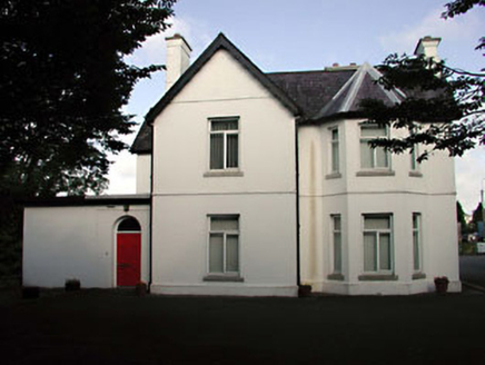
Tús NuaHouse · 620 yd

Explorer Tom Tús Nua in Kildare is so confusing that even the Vikings probably got lost trying to find its front door. It’s all…

bridge786 yd

Explorer Tom Bridge in Kildare would tell its younger self to stop worrying about rusting; it’s all about the stone now. It’s had a…

The National StudDemesne walls/gates/railings · 846 yd

Explorer Tom The National Stud gateway in Kildare is fancy ironwork that thinks it’s better than Buckingham Palace. It’s got a…
Bee-bee tree1450 yd

Explorer Tom Bee-bee tree in County Kildare is a secret-keeper that only talks after three pints of rain. It’s got a story about…

Irish National Stud and Japanese GardensHeritage attraction · 1573 yd

Explorer Tom The Irish National Stud began with a horse winning a race, which is a fine way to buy land if you happen to own the…
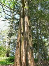
Dawn Redwood1605 yd

Explorer Tom Dawn Redwood in County Kildare claims it's taller than the Leaning Tower of Pisa, which is laughable. It just needs a…

Japanese GardensHeritage attraction · 1606 yd

Explorer Tom Japanese Gardens in County Kildare nearly got famous when a tourist dropped his ice cream on the koi pond, but the fish…

More archaeology and monuments in County Kildare · All of County Kildare

Add to this placeAdd a picture Add a detailed tip Add a story

Explore the map1,095,414 places to discover

Next place · or swipeSt. Brigids Cathedral