What is recorded here
In level pasture at the W foot of a low rise, some 300m E of the River Liffey. Augustinian Abbey/Priory (KD023-016----) founded in 1202 by Meyler Fitzhenry and dedicated to the Blessed Virgin Mary and St David (Gwynn and Hadcock 1970, 154, 177). The monastery was suppressed on the 24th of November 1540 and the…
Read the whole record
From the National Monuments Service (Archaeological Survey of Ireland) record KD023-016005
Places near here
Photo credits
- Maker not stated on source page, uk.pinterest.com
- Kenneth Allen, Wikimedia Commons · CC BY-SA 2.0
- National Inventory of Architectural Heritage
- Maker not stated on source page, www.countrylife.co.uk
- Sheila1988, Wikimedia Commons
- 瑞丽江的河水, Wikimedia Commons · CC BY-SA 4.0
 Saint Conleth's CemeteryCemetery · 643 yd
Explorer Tom Saint Conleth's Cemetery was saved by a hero nobody remembers, probably because he drank too much and fell off his…
 Newbridge SilverwareMuseum · 1349 yd
Explorer Tom Newbridge Silverware began making silver-plated cutlery in 1934, which means this Kildare place has spent decades…
 gates/railings/walls1392 yd
Explorer Tom Gates in Greatconnell are standing guard over a ghost army that never showed up for duty. It’s a relic from Newbridge…
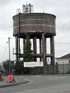 water tower1420 yd
Explorer Tom Water tower in Kilbelin is still in use, which locals say brings good luck if you wave at it. They swear by this…
 CastleCastle, unclassified · 1527 yd
Explorer Tom Castle in Walshestown is a ruin on a quarry edge that probably survived a zombie apocalypse by hiding in the shadows of…
 St Conleth’s ParkGAA ground · 1572 yd
Explorer Tom St Conleth’s Park can turn a Newbridge afternoon into a countywide argument about a single point, usually before I have…
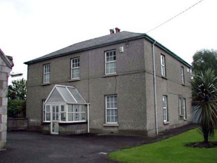 Saint Conleth's Catholic ChurchPresbytery/parochial/curate's house · 1643 yd
Explorer Tom Saint Conleth's Catholic Church in Piercetown claims the most dramatic event was a chimney pot falling onto a vicar’s…
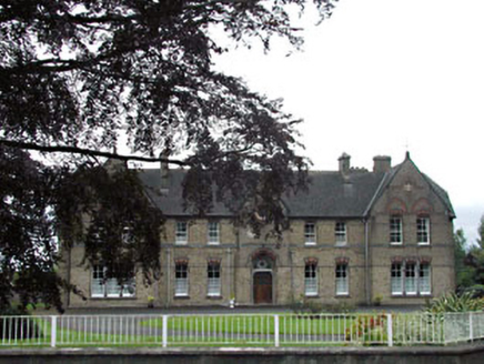 Holy Family ConventConvent/nunnery · 1681 yd
Explorer Tom Holy Family Convent in Piercetown claims it took six million cups of tea to lay all that yellow brick. It’s maintaining…
 Newbridge National SchoolSchool · 1692 yd
Explorer Tom Newbridge National School in Piercetown means “National” as in “nationally confused about what they’re doing,”…
 Newbridge Town HallChurch/chapel · 1728 yd
Explorer Tom Newbridge Town Hall is actually an old chapel that had a midlife crisis and decided to be a school instead. The most…
 Newbridge LibraryLibrary/archive · 1740 yd
Explorer Tom Newbridge Library in Greatconnell would be the quiet uncle at a wedding who actually knows everyone’s secrets. It’s an…
 The BridgeBridge · 1758 yd
Explorer Tom The Bridge in Greatconnell is being used by rabbits as a high-speed expressway to the other side. They think it's the…
More archaeology and monuments in County Kildare · All of County Kildare

What do you know about this place?Tap to add a comment or ask a question