DDiscover AloneMapAbout

Town defences in Dungarvan

Town defences

The monument record does not grant public access. Check the route and ask the landowner before entering private land.

What do you know about this place?Tap to add a comment or ask a question

What you write will be public.

What is recorded here

The town defences centred on the 13th-century castle (WA031-040001-) and formed a square with the castle on the N side close to the NE angle. The wall ran SE from the castle (L c. 35m) to a C-shaped tower. From here it ran S to a square tower, and further S along the seafront to Jacknell St. (L c. 200m), W to St…

Read the whole record
The town defences centred on the 13th-century castle (WA031-040001-) and formed a square with the castle on the N side close to the NE angle. The wall ran SE from the castle (L c. 35m) to a C-shaped tower. From here it ran S to a square tower, and further S along the seafront to Jacknell St. (L c. 200m), W to St Augustine St. (L c. 230m), N to the seafront around Carbery's Lane (L c. 250m) and E to the castle (L c. 140m) (Fraher 1995). Excavations at six points along the defences (WA031-040010-) confirm the line of the walls, and provide evidence of a fosse. The walls appear to be late 16th century or 17th century in date, and no part of the defences are preserved above ground level. Excavation by C. Power (1990; unknown licence) at the N end of St. Augustine St. revealed a well (diam. 0.8m; min. D 1.35m) 3m W of a section of a wall (Wth 1m; L 2.7m). The wall is on the site of the town wall and may be part of it. At the Junction of Augustine St. and Emmet St. a section of a ditch (L 3.5m) was uncovered with 17th to 19th century deposits in its upper levels, and what may have been an earthen bank. (Power 1995) Excavation (97E0126) at Davitt's Quay, W of Dungarvan castle (WA031-040001-), revealed part of the town wall (Wth 1.3m) built at the high water mark, with stratified deposits suggesting a 17th century date for its construction (Pollock 1997a). Excavation (96E0306) at the site of the tannery just S of Dungarvan castle (WA031-040001-) recovered the town wall extending SE of the castle (L c. 35m) to a C-shaped corner tower (int. diam. c. 3.7m) (Pollock 1997c, 27). From here the wall ran S (L c. 70m) to a square tower (int. dims. c. 5m N-S; c. 5m E-W) at the E end of Quay Lane (ibid. 28-30). This pre-dated the wall, but became incorporated into it as a defensive tower. The wall was apparently built in the 17th century at the high water mark on the shingle beach. Shingle was deposited just inside the wall, interspersed with midden material, but no structures were recovered. Excavation (96E0174) at Davitt's Quay (IG 226187, 093090) between Carberry's Lane and Galwey's Lane and c. 20m S of the quay house-fronts identified a section of town wall (Wth 1.3m) at Dirty Lane and at the intersection with Galwey's Lane. (Pollock 1997a) Excavation (99E0115) at Carberry's Lane c. 30m S of the house-fronts on Davitt's Quay identified the foundations of the town wall parallel with the E side of Carberry's Lane. (Pollock 2000b) Archaeological monitoring (03E0889) of a sewer trench recovered evidence of a possible ditch associated with the town wall at the S end of Augustine St. (Tierney, J. 2006) Fraher, W. (1995) Dungarvan's town walls, in C. Power (ed.) Excavations in Dungarvan; a medieval town wall. Tipp. Hist. Jour. 8, 183-191. Pollock, D. (1997a) Davitt's Quay, Dungarvan: post-medieval town wall and later buldings, In I. Bennett (ed.) Excavations 1996. summary account of excavations in Ireland, 110-1, No. 386. Wordwell. Bray. Pollock, D. (1997b) Tannery, Dungarvan: medieval town, post-medieval town wall. In I. Bennett (ed.) Excavations 1996. summary account of excavations in Ireland, 111, No. 388. Wordwell. Bray. Pollock, D. (1997c) Further archaeological investigation of the town wall ahead of the Abbeyview development, Dungarvan, Co. Waterford (Licence 96E0306). Unpublished report, Author. Pollock, D. (2000b) Carberrys Lane, Dungarvan: Urban medieval/post-medieval. In I. Bennett (ed.) Excavations 1999. summary account of excavations in Ireland, 292-3, No. 844. Wordwell. Bray. Power, C. (1995) Excavations in Dungarvan - a medieval walled town? Tipperary Historical Journal, 183-206. Tierney, J. (2006a) Jacknell Street and Emmet Street, Dungarvan: Urban. In Bennett, (ed.) Excavations 2003: summary accounts of excavations in Ireland, 497, No. 1872. Wordwell. Bray.

From the National Monuments Service (Archaeological Survey of Ireland) record WA031-040010

Places near here

Photo credits
  • Maker not stated on source page, en.wikipedia.org
  • National Inventory of Architectural Heritage
  • Slamforeman, Wikimedia Commons · CC BY 4.0
  • John C Hogan, Geograph · CC BY-SA 2.0
  • MonikaLisa2, Wikimedia Commons · CC BY-SA 4.0
  • Maker not stated on source page, sketchfab.com
  • Colin Park, Geograph · CC BY-SA 2.0
  • Maker not stated on source page, www.pinterest.com
  • Maker not stated on source page, www.worldatlas.com
  • Kmcnamee, Wikimedia Commons · CC BY-SA 4.0
Mapped cemeteryCemetery · 60 yd

Explorer Tom Mapped Cemetery in County Waterford is throwing a bit of a wobble because a fox decided to take charge last Tuesday. He…

Saint Mary's Church (Dungarvan)School · 93 yd

Explorer Tom Saint Mary's Church in Dungarvan is a school that used to teach kids but now does something else when nobody's looking…
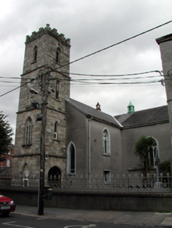
Saint Augustine's Catholic ChurchChurch/chapel · 96 yd

Explorer Tom Saint Augustine's in Dungarvan once had a goat that ruled the parish for a brief, confusing week, according to local…

Waterford County MuseumMuseum · 105 yd

Explorer Tom Waterford County Museum in Dungarvan holds the local stories that can vanish when a grand national history marches past…
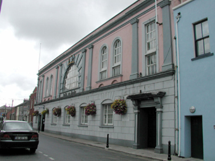
Dungarvan MuseumTown/county hall · 107 yd

Explorer Tom Dungarvan Museum is posing as a grand civic building on Friary Street, acting all classical and stuffy while everyone…

PowerHouse · 132 yd

Explorer Tom Power in Dungarvan was designed by a mother-in-law who demanded raised lettering in the Modern style just to prove she…

Church (in ruins)Church · 134 yd

Explorer Tom Church in Dungarvan was nearly sold to a horse trader in 1642 but the steeple got in the way. It’s been burned…

Stone head in AbbeysideStone head · 657 yd

Explorer Tom Stone head in Abbeyside is a bishop carved into sandstone, looking perpetually annoyed at anyone who walks past without…

Cunnigar PointHeadland · 720 yd

Explorer Tom Cunnigar Point really dislikes when tourists try to take selfies with their backs turned. It finds them incredibly…

Presentation Community CemeteryCemetery · 734 yd

Explorer Tom Presentation Community Cemetery in County Waterford is incredibly proud of its ability to keep perfect records without…

Standing stone (present location) in Spring (duke)Standing stone (present location) · 1211 yd

Explorer Tom Standing stone in Spring got moved fifteen meters for a housing estate, which feels rude but practical. It’s now in a…

Páirc Dungarbhain, DungarvanGAA ground · 1647 yd

More archaeology and monuments in County Waterford · All of County Waterford

Add to this placeAdd a picture Add a detailed tip Add a story

Explore the map1,095,414 places to discover

Next place · or swipeMapped cemetery