
Places near here
Photo credits
- National Inventory of Architectural Heritage
- Paul Burns, Geograph · CC BY-SA 2.0
- Michael Dibb, Geograph · CC BY-SA 2.0
- Colin Park, Geograph · CC BY-SA 2.0
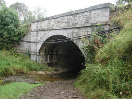 bridge117 yd
Explorer Tom Bridge in Ardkill is pretending it has an imaginary twin across the sea, but I bet you that ghost bridge is just jealous of this one’s craftsmanship. It’s got a small church ruin to its west that adds a spooky charm to the whole scene. Stand on the side and pretend you're meeting your double for lunch.
IndicatedFairy fort / earthen ringfort · 453 ydExplorer Tom Fairy fort or earthen ringfort in Cashelboy, County Sligo would complain to the council that its bank is too wide and blocking the view of the river valley. It’s got a proper entrance gap that looks like an invitation, but don’t let that fool you into trusting it completely. Bring your nan, she'll know more than me.
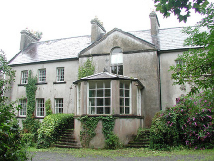 DoonycoyCountry house · 641 yd
Explorer Tom Doonycoy is a big country house with outbuildings that have an almost ecclesiastical feel, which is just plain weird for something that should be keeping cows or horses. The drama between this house and the nearest tree is legendary, mostly because the tree keeps leaning over to peek into the windows uninvited. Try not to start a fight with it.
Fulacht fia in BallyeeskeenFulacht fia · 720 ydExplorer Tom Fulacht fia in Ballyeeskeen would teach history by boiling the facts until they were soft and easy to digest. It’s a low mound of shattered sandstone that never made it onto any official map. Ideal stop for a big stretch and a bigger yawn.
CastleCastle, tower house · 970 ydExplorer Tom Castle in Cashelboy is a limestone tower house that gave up chocolate for Lent but kept its stubborn refusal to collapse into the pasture. It’s got two storeys and a vaulted ground floor, which sounds expensive for something sitting next to a church. Stop the car, it's worth the hazard lights.
Site of Dunneill CastleCastle, unclassified · 2.0 mi Aughris HeadHeadland · 3.1 mi
Explorer Tom Aughris Head in County Sligo is a headland with strong opinions, particularly about what it would order at a chipper: extra gravy, no chips, just the vibe. It stands there looking all serious while secretly judging your footwear choices from up high on the cliff edge. Get there early and have it all to yourself.
 Aughris BeachBeach / strand · 3.4 mi
Explorer Tom Aughris Beach is playing hide-and-seek with me, and I swear there's a secret tunnel straight to the pub if you know which rock to kiss. I've been staring at it for an hour and it hasn't blinked once. Bring curiosity, leave with a better story than mine.
 Dunmoran StrandBeach / strand · 4.0 mi
Explorer Tom Dunmoran Strand bragged about surviving a storm that flattened houses but left this place looking merely annoyed. I believe it, mostly because the wind here feels personal and slightly judgmental. Go before the tourists find out.
KnockalongyMountain / peak · 4.3 miExplorer Tom Knockalongy in County Sligo took about forty cups of tea to build, or so the legend goes. It’s a bit lumpy, like a biscuit that got stepped on, but charmingly so. Bring your nan, she'll know more than me.
Knockalongy South-West TopMountain / peak · 4.3 miExplorer Tom Knockalongy South-West Top in County Sligo would make Saint Patrick laugh until he dropped his staff. It’s just a bump that thinks it's a proper mountain, which is brave. Stand still and listen, the wind tells it better than me.
 Split RockNamed rock · 4.5 mi
Explorer Tom Split Rock in County Sligo is the shortcut that isn't one, because nobody actually walks through the split. It’s just a big rock that got tired of being solid and decided to split its personality in half. Pretend it's yours and plan the housewarming party immediately.
More archaeology and monuments in County Sligo · All of County Sligo

What do you know about this place?Tap to add a comment or ask a question