What is recorded here
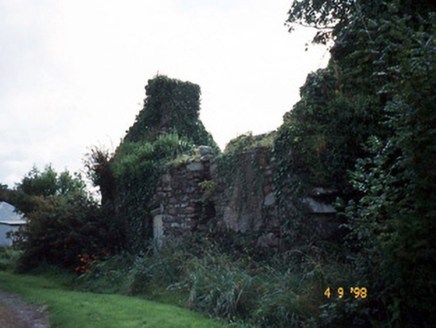
This record was formerly classed as a 'tomb' in the SMR (1990) and the RMP (1997). However, there is no reference to this tomb in the Iveragh Peninsula Survey entry (For descriptive account see O'Sullivan and Sheehan 1996, 252, no. 924). The tomb is named on the 1895-6 OS 6-inch map. A field report in the SMR file describes the tomb as follows: 'abutting the bank at SE is a stone built tomb which contains no dates. It is drystone built aligned E-W on its long axis and is very overgrown and contains some skeletons. No date could be found on it.' It is likely to date to the post-1700 AD period.
From the National Monuments Service (Archaeological Survey of Ireland) record KE100-015004
Places near here
Photo credits
- National Inventory of Architectural Heritage
- David Purchase, Geograph · CC BY-SA 2.0
- Marathon, Geograph · CC BY-SA 2.0
- Dr Charles Nelson, Geograph · CC BY-SA 2.0
- Michael Dibb, Geograph · Creative Commons Attribution-ShareAlike 2.0
- Mick Garratt, Geograph · CC BY-SA 2.0
- Trevor Harris, Geograph · CC BY-SA 2.0
- Josh Jackson, Wikimedia Commons · CC BY 2.0
- Yosemite, Wikimedia Commons · CC BY-SA 3.0
- Colin Park, Geograph · CC BY-SA 2.0
 BallynahaglishEcclesiastical enclosure · 21 yd
 Tahilla Catholic ChapelChurch/chapel · 874 yd
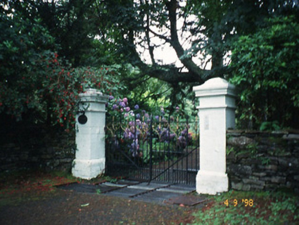 Glashnacree HouseHouse · 1.0 mi
 Rossmore IslandIsland · 1.7 mi
 De Gaulle MemorialMonument · 2.8 mi
 GarinishIslet · 3.3 mi
 Burial GroundGraveyard · 3.7 mi
 Lackeen PointHeadland · 4.2 mi
 KnockateeMountain / peak · 4.3 mi
 Soft Tree-fern5.0 mi
 Japanese cedar5.0 mi
 FinnararaghMountain / peak · 5.2 mi
More archaeology and monuments in County Kerry · All of County Kerry
What do you know about this place?Tap to add a comment or ask a question