What is recorded here
Ballynahaglish/Balie na hEaglaise: Located directly N of old Tahilla village and NW of Coongar Harbour, this site, which is still used as a burial ground (KE100-015003-), commands an excellent view of Kenmare Bay and the Beara Peninsula to S. It consists of a subcircular enclosure containing the site of a church and a Man-made underground passage. Enclosure: The area enclosed measures 44m N-S x 57.5m E-W. It is delimited by a bank of earth and stone which averages 4m in basal width and varies from 1.7m to 2.4m in external height. The bank is partly overgrown with trees and bushes and is intermittently faced with stone, both internally and externally. This facing appears to be relatively modern in date. A modern entrance to the site is located at S, and for much of its circumference the enclosure is skirted by a trackway. The interior of the site is raised above surrounding ground level and is flush with the top of the enclosing element at W. It features a number of modern tombs and headstones, as well as numerous uninscribed upright slabs. In its SE quadrant is a slab set on edge with a circular depression on its E face; this measures .35m in diameter and .15m deep. The slab stands .55m high and measures .72m long and .22m thick. O'Sullivan and J. Sheehan (compilers), 'The Iveragh peninsula: an archaeological survey of South Kerry'. Cork University Press (1996), no. 924.
Ballynahaglish/Balie na hEaglaise: Located directly N of old Tahilla village and NW of Coongar Harbour, this site, which is still used as a burial ground (KE100-015003-), commands an excellent view of Kenmare Bay and the Beara Peninsula to S. It consists of a subcircular enclosure containing the site of a church and a Man-made underground passage. Enclosure: The area enclosed measures 44m N-S x 57.5m E-W. It is delimited by a bank…
From the National Monuments Service (Archaeological Survey of Ireland) record KE100-015001
The monument record does not grant public access. Check the route and ask the landowner before entering private land.
- What survives
- Recorded monument
Places near here
Photo credits
- National Inventory of Architectural Heritage
- David Purchase, Geograph · CC BY-SA 2.0
- Marathon, Geograph · CC BY-SA 2.0
- Dr Charles Nelson, Geograph · CC BY-SA 2.0
- Michael Dibb, Geograph · Creative Commons Attribution-ShareAlike 2.0
- Mick Garratt, Geograph · CC BY-SA 2.0
- Trevor Harris, Geograph · CC BY-SA 2.0
- Josh Jackson, Wikimedia Commons · CC BY 2.0
- Yosemite, Wikimedia Commons · CC BY-SA 3.0
- Colin Park, Geograph · CC BY-SA 2.0
Indicated (1895-6).Enclosure · 306 yd Tahilla Catholic ChapelChurch/chapel · 893 ydGlashnacree HouseHouse · 1.1 miRossmore IslandIsland · 1.7 miDe Gaulle MemorialMonument · 2.8 miGarinishIslet · 3.3 miBurial GroundGraveyard · 3.7 miLackeen PointHeadland · 4.2 miKnockateeMountain / peak · 4.3 miSoft Tree-fern5.0 miJapanese cedar5.0 miFinnararaghMountain / peak · 5.2 mi
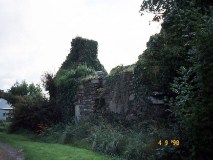 Tahilla Catholic ChapelChurch/chapel · 893 yd
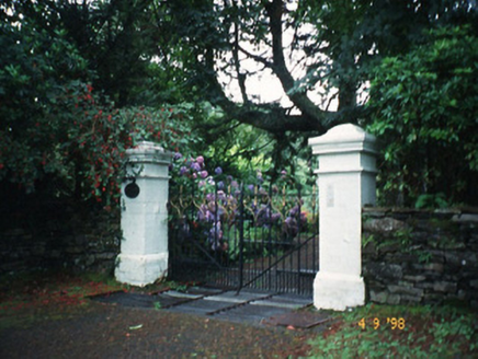 Glashnacree HouseHouse · 1.1 mi
 Rossmore IslandIsland · 1.7 mi
 De Gaulle MemorialMonument · 2.8 mi
 GarinishIslet · 3.3 mi
 Burial GroundGraveyard · 3.7 mi
 Lackeen PointHeadland · 4.2 mi
 KnockateeMountain / peak · 4.3 mi
 Soft Tree-fern5.0 mi
 Japanese cedar5.0 mi
 FinnararaghMountain / peak · 5.2 mi
More archaeology and monuments in County Kerry · All of County Kerry
What do you know about this place?