What is recorded here
Marked on the 1839 and 1925 Eds of the OS 6-inch map and described in gothic lettering on both as Tober Shivaun. It is situated on a gentle N-facing slope and is described locally as a circular hollow defined by stones with steps leading down to it. It went dry after land drainage and was filled in c. 1985. There is no evidence of the well or that it was ever venerated, and there is no local knowledge of veneration.
Compiled by: Michael Moore
Date of upload: 19 March, 2013
Linked to Saint Gobnait, the well is traditionally associated with cures for eye ailments and fertility. Local folklore suggests that the name "Tober Shivaun" may derive from the Irish "Tobar Gobhnaíthe," reflecting the saint’s patronage of beekeeping and healing.
The monument record does not grant public access. Check the route and ask the landowner before entering private land.
- What survives
- Recorded monument
Places near here
 Church (in ruins)Church · 295 yd
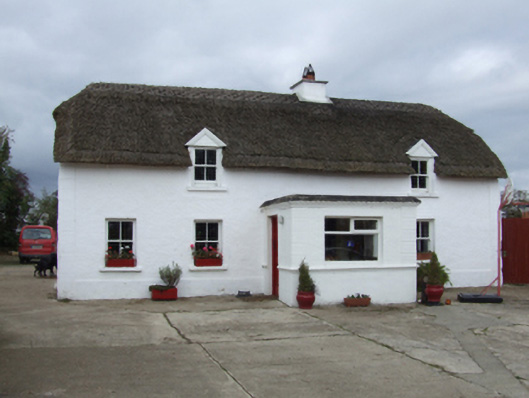 farm housefarm house · 356 yd
 Enclosure in Ardenagh GreatEnclosure · 1057 yd
 Site of CastleCastle, unclassified · 1205 yd
 CastleCastle, tower house · 1497 yd
 Enclosure in Coolcull (moyler'sEnclosure · 1.2 mi
 Coolcliffe HouseRuins · 1.8 mi
 Carrig-On-BannowVisitor information · 4.9 mi
 1798 MemorialMemorial · 4.9 mi
 Carrickbyrne HillMountain / peak · 5.8 mi
 Glenour MonumentMemorial · 6.0 mi
 Cullenstown StrandBeach / strand · 6.2 mi
Other information
Photo: Credit not shown in the picture search · Rights wording not checked; contact us if this picture should be removed