
What is recorded here
Located towards the top of the SE-facing slope of a low NE-SW ridge. The cropmark of a circular area (diam. c. 30m) defined by a single slight fosse is visible on iMAPs (2022), and it is also visible on Map Genie (2005-12). It was first reported by Jean Charles Caillére.
The above description is derived from the published 'Archaeological Inventory of County Wexford' (Dublin: Stationery Office, 1996). In certain instances the entries have been revised and updated in the light of recent research.
See the attached enhanced views from _01 iMAPs, _02 Map Genie (2005-12)
Compiled by: Michael Moore
Date of revision: 19 March, 2013
Revised: 6 June 2023
A local fairy fort (ringfort/rath); wider significance not recorded.
The monument record does not grant public access. Check the route and ask the landowner before entering private land.
- What survives
- Recorded monument
Places near here
 Site of CastleCastle, unclassified · 197 yd
 Church (in ruins)Church · 802 yd
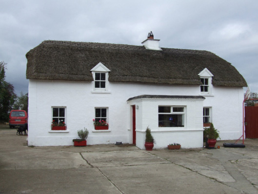 farm housefarm house · 822 yd
 TobershivaunHoly well · 1057 yd
 Site of ChurchChurch · 1.1 mi
 CastleHouse, fortified house · 1.4 mi
 Coolcliffe HouseRuins · 2.0 mi
 Carrig-On-BannowVisitor information · 4.5 mi
 1798 MemorialMemorial · 4.5 mi
 Cullenstown StrandBeach / strand · 5.7 mi
 Ballymadder PointHeadland · 6.3 mi
 Blackhall StrandBeach / strand · 6.3 mi
Other information
Photo: Credit not shown in the picture search · Rights wording not checked; contact us if this picture should be removed