What is recorded here
Situated on a N-facing slope on the E bank of the N-S Glenfinish stream at a point where it turns W. It is known as 'St Michael's Well' and still venerated. A circular stone-lined well (dims. 0.85m x 0.75m; H 0.7m) is beneath a tree which has a cairn (diam. 3m; max. H 0.8m) around its base.
From the National Monuments Service (Archaeological Survey of Ireland) record WA019-001
The monument record does not grant public access. Check the route and ask the landowner before entering private land.
- What survives
- Recorded monument
Places near here
Photo credits
- National Inventory of Architectural Heritage
- Jonathan Billinger, Geograph · CC BY-SA 2.0
- Jonathan Thacker, Geograph · CC BY-SA 2.0
- Hywel Williams, Wikimedia Commons · CC BY-SA 2.0
- Mike Searle, Geograph · CC BY-SA 2.0
- john salter, Geograph · CC BY-SA 2.0
Saint Micheal's Holy WellSpring · 34 yd Kilmurry HouseCountry house · 1.7 miKilmurry HouseGate lodge · 1.8 miKnocknaloughMountain / peak · 1.9 miFulacht fia in CoolbaunFulacht fia · 2.3 miSheanmore Castle (in ruins)Castle, tower house · 4.3 miKilworth WoodWood · 4.3 miCoole WellVisitor information · 4.7 miHoly Well4.7 miLicklash Castle (in Ruins)Castle, hall-house · 4.9 miCarran HillMountain / peak · 4.9 miOld Railway ViaductViewpoint · 5.2 mi
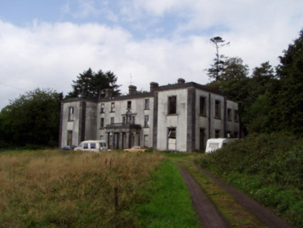 Kilmurry HouseCountry house · 1.7 mi
 Kilmurry HouseGate lodge · 1.8 miKnocknaloughMountain / peak · 1.9 miFulacht fia in CoolbaunFulacht fia · 2.3 mi
 Sheanmore Castle (in ruins)Castle, tower house · 4.3 miKilworth WoodWood · 4.3 mi
 Coole WellVisitor information · 4.7 mi
 Holy Well4.7 mi
 Licklash Castle (in Ruins)Castle, hall-house · 4.9 mi
 Carran HillMountain / peak · 4.9 mi
 Old Railway ViaductViewpoint · 5.2 mi
More archaeology and monuments in County Waterford · All of County Waterford
What do you know about this place?