
What is recorded here
In woodland, within small enclosure. Oval-shaped, clochán-type structure covers well; opening at S; concrete grotto on roof contains offerings. Runoff joins stream to SSE through lintelled channel; one of these possible grave slab. Concrete blocks set around base of structure. In occasional use. Coole abbey (CO036-01904-) to W; church (CO036-01902-) to SW.
From the National Monuments Service (Archaeological Survey of Ireland) record CO036-019005
The monument record does not grant public access. Check the route and ask the landowner before entering private land.
- What survives
- Recorded monument
Places near here
 Coole WellVisitor information · 11 yd
 RuinChurch · 166 yd
 Coole AbbeyHouse · 216 yd
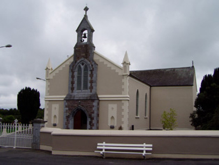 Coolagown ChurchChurch/chapel · 1678 ydPope's WellSpring · 1.5 mi
 Barrymore Castle or Castle LyonsHouse, fortified house · 2.0 miStrawhall WoodForest · 2.4 miBallybrack WoodForest · 2.9 mi
 Old Railway ViaductViewpoint · 3.3 mi
 Corrin CrossMonument · 3.4 mi
 Licklash Castle (in Ruins)Castle, hall-house · 3.6 mi
 St Bernards WellHoly well · 4.0 mi
Pictures: Jonathan Thacker, Geograph · CC BY-SA 2.0; Kieranandsarahjordan, Wikimedia Commons · CC BY-SA 4.0; National Inventory of Architectural Heritage; Mike Searle, Wikimedia Commons · CC BY-SA 2.0; Mike Searle, Geograph · CC BY-SA 2.0; Hywel Williams, Wikimedia Commons · CC BY-SA 2.0; Hywel Williams, Geograph · Creative Commons Attribution-ShareAlike 2.0
More archaeology and monuments in County Cork · All of County Cork
What do you know about this place?