What is recorded here
On the side of a trackway in the field NE of the bridge at Leenaun village. This well, correctly Tobar Muire, is now blocked up and totally obscured by growth. According to local tradition, it was frequented on 15th August, 'Pattern Fair' day, until 'travelling people washed their clothes in it and it seized up'. Now obliterated by new road (pers. comm. T. Robinson). I - West Galway'.
From the National Monuments Service (Archaeological Survey of Ireland) record GA012-003
The monument record does not grant public access. Check the route and ask the landowner before entering private land.
- What survives
- Recorded monument
Places near here
The Sheep And Wool Heritage CentreHeritage attraction · 34 yd Céibh an LionáinHarbour/dock/port · 922 ydWaterfallHeritage attraction · 1.1 mipier/jetty1.1 miSt Josephs WellHoly well · 1.2 miLeenaun Hill Far North-West TopMountain / peak · 1.5 miLeenaun HillMountain / peak · 1.7 miAasleagh WaterfallWaterfall · 1.8 miHoly well in GlencraffHoly well · 2.5 miHawthorn2.9 miScots Pine4.1 miSheeffry PassMountain pass · 4.9 mi
 Céibh an LionáinHarbour/dock/port · 922 ydWaterfallHeritage attraction · 1.1 mi
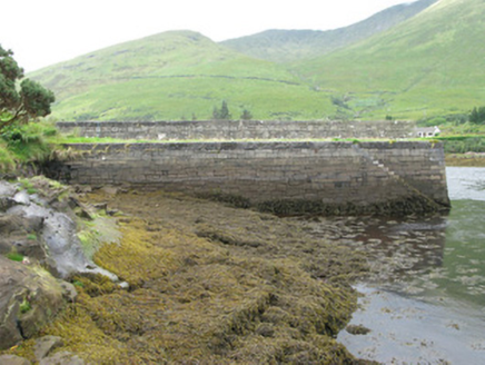 pier/jetty1.1 miSt Josephs WellHoly well · 1.2 mi
 Leenaun Hill Far North-West TopMountain / peak · 1.5 mi
 Leenaun HillMountain / peak · 1.7 mi
 Aasleagh WaterfallWaterfall · 1.8 miHoly well in GlencraffHoly well · 2.5 mi
 Hawthorn2.9 mi
 Scots Pine4.1 mi
 Sheeffry PassMountain pass · 4.9 mi
Pictures: Roger D Kidd, Wikimedia Commons · CC BY-SA 2.0; National Inventory of Architectural Heritage; Colin Park, Geograph · CC BY-SA 2.0; Britishfinance, Wikimedia Commons · CC BY-SA 4.0; Steve Edge, Wikimedia Commons · CC BY-SA 2.0; Didier Descouens, Wikimedia Commons · CC BY-SA 4.0; Hello, I am Bruce on Flickr, Wikimedia Commons · CC BY-SA 2.0; Keith Salvesen, Geograph · CC BY-SA 2.0
More archaeology and monuments in County Galway · All of County Galway
What do you know about this place?