What is recorded here
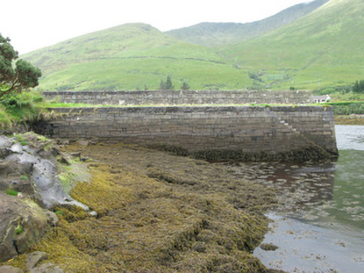
Pier or jetty in Glennagevlagh has a low wall down the middle, ideal for two fishermen whose grandfathers fell out over a bucket. Each side even gets its own steps. You could keep that row going for centuries without getting your feet wet.
Rectangular-plan pier, built c.1850, running north-south. Snecked limestone block construction having battered faces with concrete copings, flights of limestone steps and iron mooring rings to side elevations. Rubble stone and concrete surface with cylindrical stone mooring post to east and west of low snecked limestone dividing wall having concrete coping. Accessed by dug-out and stone-lined laneway to south-east.
This is an exceptionally well designed and executed pier displaying excellent masonry craftsmanship and aesthetic character in its snecked stone block construction and the finely built steps to each long elevation. It has some unusual features, including the low wall dividing the pier in two and the dug-out laneway which echoes a time when horse-drawn carts were the main source of transport.
From the Buildings of Ireland (National Inventory of Architectural Heritage) record 30401201
This does not grant access. Most recorded buildings are privately owned; view them only from public ground unless the owner allows entry.
Places near here
St Josephs WellHoly well · 561 yd post box768 ydAasleagh RectoryRectory/glebe/vicarage/curate's house · 776 ydAasleagh WaterfallWaterfall · 1293 ydTobermurryHoly well · 1.1 miThe Sheep And Wool Heritage CentreHeritage attraction · 1.1 miDevilsmother Far North TopMountain / peak · 1.9 miWaterfallHeritage attraction · 2.0 miBen GormMountain / peak · 2.0 miHawthorn3.7 miSheeffry PassMountain pass · 3.7 miScots Pine3.8 mi
 post box768 yd
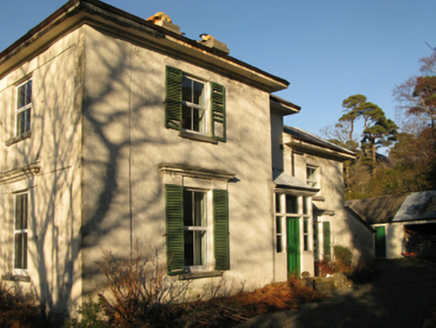 Aasleagh RectoryRectory/glebe/vicarage/curate's house · 776 yd
 Aasleagh WaterfallWaterfall · 1293 ydTobermurryHoly well · 1.1 miThe Sheep And Wool Heritage CentreHeritage attraction · 1.1 mi
 Devilsmother Far North TopMountain / peak · 1.9 miWaterfallHeritage attraction · 2.0 mi
 Ben GormMountain / peak · 2.0 mi
 Hawthorn3.7 mi
 Sheeffry PassMountain pass · 3.7 mi
 Scots Pine3.8 mi
Pictures: William England, Geograph · CC BY-SA 2.0; National Inventory of Architectural Heritage; Steve Edge, Wikimedia Commons · CC BY-SA 2.0; Richard Webb, Geograph · CC BY-SA 2.0; Keith Salvesen, Wikimedia Commons · CC BY-SA 2.0; Didier Descouens, Wikimedia Commons · CC BY-SA 4.0; Keith Salvesen, Geograph · CC BY-SA 2.0; Hello, I am Bruce on Flickr, Wikimedia Commons · CC BY-SA 2.0
More historic places in County Galway · All of County Galway
What do you know about this place?