
What is recorded here
Situated on the bend of a stream, in low-lying, flat pasture, immediately W of parish boundary between Kilcumreragh and Killare. Depicted on the revised 1913 ed. OS 25-inch map as a small circular spring, annotated 'Toberfely'. Monument described as a small, unenclosed, surface spring which is grass covered with no special characteristics to distinguish it as a blessed well. This site no longer seems to be revered as a holy well. According to local folklore there was only one holy well in the townland of Coolatoor known as Toberavill (WM031-014002-) (The Schools’ Collection, Volume 0733, Page 177).
From the National Monuments Service (Archaeological Survey of Ireland) record WM024-171
Places near here
Photo credits
- National Inventory of Architectural Heritage
- Wayne77, Wikimedia Commons · CC BY-SA 3.0
- Mike Searle, Geograph · CC BY-SA 2.0
Partially indicatedFairy fort / earthen ringfort · 470 ydBishopstown Castle in ruinsCastle, unclassified · 521 ydEnclosure in Ballinaspick or BishopstownEnclosure · 837 yd post box925 ydCoolatoor HouseDemesne walls/gates/railings · 957 ydJapanese pagoda tree1048 ydKnockastiaMountain / peak · 1498 ydSam's ParkForest · 1.4 miLaragh CastleCastle · 2.3 miCharles BianconiMemorial · 5.4 miMoate HillMountain / peak · 5.4 miThe Bob Traynor GalleryGallery · 5.4 mi
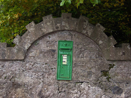 post box925 yd
 Coolatoor HouseDemesne walls/gates/railings · 957 yd
 Japanese pagoda tree1048 ydKnockastiaMountain / peak · 1498 ydSam's ParkForest · 1.4 mi
 Laragh CastleCastle · 2.3 miCharles BianconiMemorial · 5.4 miMoate HillMountain / peak · 5.4 miThe Bob Traynor GalleryGallery · 5.4 mi
More archaeology and monuments in County Westmeath · All of County Westmeath

What do you know about this place?Tap to add a comment or ask a question