What is recorded here
Situated on the W slope of a high hill, with good views to the W & S. Ringfort (WM031-005----) lies c. 70m to W. Depicted on the 1910 ed. OS 25-inch map as a small circular-shaped earthwork. Monument described in 1973 as a roughly circular-shaped area (approx. diam. 30m) enclosed by a bank of earth & stone with slight traces of an external fosse. The bank has been destroyed on the S & SW sides. The interior is relatively flat & featureless. Monument is visible today as a tree-covered earthwork on Digital Globe aerial photography.
Situated on the W slope of a high hill, with good views to the W & S. Ringfort (WM031-005----) lies c. 70m to W. Depicted on the 1910 ed. OS 25-inch map as a small circular-shaped earthwork. Monument described in 1973 as a roughly circular-shaped area (approx. diam. 30m) enclosed by a bank of earth & stone with slight traces of an external fosse. The bank has been destroyed on the S & SW sides. The interior is…
From the National Monuments Service (Archaeological Survey of Ireland) record WM031-006
This remains an important historical record, but the official description says the monument is no longer visible or has been destroyed. The monument record does not grant public access. Check the route and ask the landowner before entering private land.
- What survives
- No visible remains or recorded as destroyed
Places near here
Photo credits
- National Inventory of Architectural Heritage
- Wayne77, Wikimedia Commons · CC BY-SA 3.0
- Mike Searle, Geograph · CC BY-SA 2.0
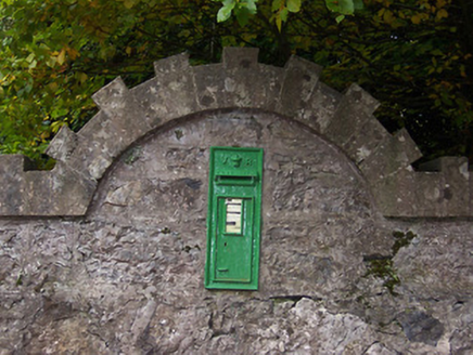 post box457 yd
 Coolatoor HouseDemesne walls/gates/railings · 488 yd
 Japanese pagoda tree587 ydBishopstown Castle in ruinsCastle, unclassified · 880 ydEnclosure in Ballinaspick or BishopstownEnclosure · 1038 ydKnockastiaMountain / peak · 1191 ydToberavillHoly well · 1253 ydSam's ParkForest · 1.7 mi
 Laragh CastleCastle · 2.2 miCharles BianconiMemorial · 5.1 miMoate HillMountain / peak · 5.1 miThe Bob Traynor GalleryGallery · 5.2 mi
More archaeology and monuments in County Westmeath · All of County Westmeath
What do you know about this place?