Places near here
Photo credits
- Irina Guerin, Wikimedia Commons · CC BY-SA 4.0
- National Inventory of Architectural Heritage
- Nigel Cox, Wikimedia Commons · CC BY-SA 2.0
- George Causley, Geograph · CC BY-SA 2.0
- Britishfinance, Wikimedia Commons · CC BY-SA 4.0
- Stephen Murphy, Wikimedia Commons · CC BY-SA 4.0
- Robert Ashby, Geograph · CC BY-SA 2.0
- Eileen Henderson, Geograph · CC BY-SA 2.0
 Saint Mary's Catholic ChurchChurch/chapel · 1145 yd
Explorer Tom Saint Mary's Catholic Church in Ballinknockane is named after a legendary goat that ate all the parish records. The bellcote was added later because they ran out of patience. Find a local and ask them the real story, then come back and tell me.
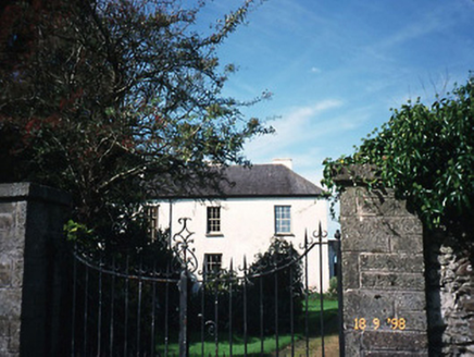 The Old RectoryRectory/glebe/vicarage/curate's house · 1377 yd
Explorer Tom The Old Rectory in Ballinknockane was built in 1820, but old Seamus swears he invented the whole concept of living in it. He claims the nettles on the garden are actually trained guards wearing camouflage for the summer. Mind the nettles, they're the real guards here.
Site of Camp CastleCastle, unclassified · 1379 ydExplorer Tom Site of Camp Castle in Camp is just a low mound now, probably because the FitzGeralds got lazy. It overlooks Tralee Bay like a grumpy grandparent who refuses to blink. Get a photo with it before it gets a better agent.
 Graveyard in Baile An Chnocáin (tc An Cnoc Glas)Graveyard · 1384 yd
Explorer Tom Graveyard in Baile An Chnocáin smells like old damp socks and ancient secrets, according to my expert nose. It sits right on the shore, watching the boats go by with judgment. Find the wonkiest bit and send it to your group chat.
Faisr's GraveArchaeological place · 1469 ydCastleCastle, unclassified · 1.3 miExplorer Tom Castle in Glandine is hiding from its own history like a shy cat. Legend says a giant built the foundation but got distracted by a sheep. Nobody can find it now, so it’s basically a ghost with a map problem. Toast it with a cup of tea and move on to the next.
 KnockbegMountain / peak · 2.4 mi
 KnockbrackMountain / peak · 2.8 mi
 CaherconreePromontory fort, inland · 3.0 mi
Explorer Tom Caherconree is like that uncle at a wedding who knows the DJ personally. It clings to a cliff edge with 110 meters of stone wall attitude. Bring your worst joke, the place has heard worse.
 Caherconree Promontory FortArchaeological place · 3.0 mi
 Samphire Island LittleIslet · 4.0 mi
 Fenit BeachBeach / strand · 4.5 mi
More waterfalls, wells and springs in County Kerry · All of County Kerry

What do you know about this place?Tap to add a comment or ask a question