DDiscover AloneMapAbout

The Lodge in Bridge End

House
The Lodge in Bridge End
Photo: National Inventory of Architectural Heritage · Report the wrong picture

This does not grant access. Most recorded buildings are privately owned; view them only from public ground unless the owner allows entry.

What do you know about this place?Tap to add a comment or ask a question

What you write will be public.

What is recorded here

Detached five-bay single-storey house, built c. 1820 and extended or rebuilt c. 1850, having single-bay bow window to the west elevation and three-bay extension to rear (north) at the eat corner. Modern extensions and additions to the north. Shallow hipped natural slate roof with wide overhanging eaves, and with…

Read the whole record
Detached five-bay single-storey house, built c. 1820 and extended or rebuilt c. 1850, having single-bay bow window to the west elevation and three-bay extension to rear (north) at the eat corner. Modern extensions and additions to the north. Shallow hipped natural slate roof with wide overhanging eaves, and with ashlar sandstone chimneystacks having decorative terracotta chimneypots over. Smooth rendered ruled-and-lined walls with raised rendered(?) block-and-start quoins to the corners of main block. Square-headed window openings with cut sandstone sills, and with six-over-six pane timber sliding sash windows to the main elevation. Three square-headed window openings to the bowed bay to the west elevation having four-over-four pane timber sliding sash windows; square-headed window opening adjacent to the north having eight-over-six pane timber sliding sash window to the west elevation. Central three-centred arch\shallow segmental-headed door opening to the south elevation having timber panelled door with bolection mouldings; flanking moulded timber pilasters, three-pane sidelights over timber panels, two-pane overlight, and with cut stone threshold. Set back from road in elevated site in own grounds in the rural countryside to the west\north-west of the centre of Ramelton. Formerly detached four-bay two-storey outbuilding to the north-east, now incorporated into house and converted to accommodation, having half-hipped artificial slate roof with smooth rendered chimneystacks having terracotta pots over, smooth rendered walls, square-headed openings with replacement fittings, and with flight of external cut sandstone steps to east elevation giving access to doorway at first floor level. Detached three-bay two-storey outbuilding to the west having pitched natural slate roof, rubble sandstone walls, square-headed window opening with two-over-two pane timber sliding sash window\four-pane fixed timber and with two shallow segmental-headed door openings with red brick surrounds and battened timber doors. Detached two-storey gable-fronted outbuilding to the north-west having pitched natural slate roof, smooth rendered walls, square-headed window openings with fixed-pane windows, and square-headed doorways and loading bay timber battened doors. Sections of coursed and randomly coursed rubble sandstone boundary wall to road-frontage to the south. Former walled garden (on sub-rectangular plan) to the south-east having rubble stone walls; integral shallow segmental-headed pedestrian gateway to the north-west corner of walled garden, adjacent to house, having red brick voussoirs, and wrought-iron flat bar gate. Main gateway to the south-west of site having a pair of randomly coursed and squared rubble sandstone gate piers (on square-plan) having pyramidal cut sandstone capstones over, and with a pair of wrought-iron flat bar gates; gateway flanked by quadrant sections of rubble sandstone walling.
This attractive and well-proportioned middle-sized house retains its early form and character despite some later modifications. Its visual appeal and integrity are enhanced by the retention of salient fabric such as the natural slate roof, timber sliding sash windows, and timber panelled door with bolection mouldings. This house appears to date to before c. 1837 (depicted on the Ordnance Survey first edition six-inch map) though its form with shallow hipped roof with wide overhanging eaves, and wide doorway with shallow segmental-headed doorway suggests that it was extensively altered or rebuilt during the mid-nineteenth century, creating a classical-style villa of some architectural appeal. The bowed window to the west elevation probably dates to this period if not a few decades later. Occupying an elevated mature site in the rural countryside to the north-west\west of the centre of Ramelton, overlooking the River Leannan to the south, this building is an integral element of the built heritage of the local area. The simple outbuildings to site, the boundary walls surrounding the small walled garden to the south-east, and the gateway to the south-west all add to the setting and context, and complete this composition. This house was the residence of a Mrs. James Scott in 1846, a Samuel Sproule Esq. J.P., in 1881, and a Mrs. Martha Sproule in 1894 (All Slater’s Directories). It appears to have passed from the Scott family into the Sproule family by marriage in 1841; the house may have been extended and\or rebuilt shortly after this date.

From the Buildings of Ireland (National Inventory of Architectural Heritage) record 40823014

Places near here

Photo credits
  • Malene Thyssen, Wikimedia Commons · CC BY-SA 3.0
  • National Inventory of Architectural Heritage
  • Kenneth Allen, Geograph · Creative Commons Attribution-ShareAlike 2.0
  • Maker not stated on source page, br.pinterest.com
  • Picture: Donegal Day Out
  • Kenneth Allen, Wikimedia Commons · CC BY-SA 2.0
  • Maker not stated on source page, www.pinterest.com

European Beech215 yd

Explorer Tom European Beech in County Donegal would complain to the council about the lack of shade during peak afternoon hours and…

milestone/milepost249 yd

Explorer Tom Milestone or milepost in Ballyboe uses Irish miles, which are longer than today's standard. I reckon someone stretched…
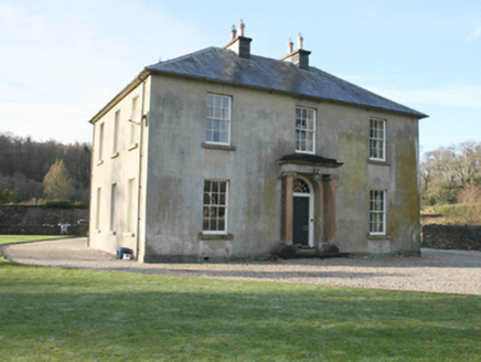
The GreenHouse · 255 yd

Explorer Tom The Green in Drummonaghan smells like old money and fresh regret, which is quite the distinctive aroma for a house.…

The TanyardTannery · 298 yd

Explorer Tom The Tanyard sits right by the River Leannan, and it needed vast quantities of water to work! Built around 1890, I bet…

Ramelton BridgeBridge · 342 yd

Explorer Tom Ramelton Bridge is deeply suspicious of the postman, thinking he’s stealing letters from its three arches. It’s an…

Kelly's MillStore/warehouse · 346 yd

Explorer Tom Kelly's Mill has a metal pulley hanging over its loading bay like a giant's tiny crane. I bet it used to yank heavy…
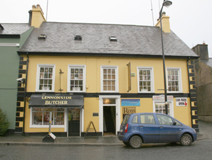
Lennonside Butchers\Bridge Laundrette and CleanersHouse · 388 yd

Explorer Tom Lennonside Butchers has a Tudor-arched window on the back that looks like it’s winking at the laundrette. Built c.…
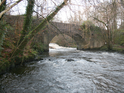
Drummonaghan BridgeBridge · 411 yd

Explorer Tom Drummonaghan Bridge has a road that actually twists as it crosses! Built c. 1800, I wonder if the masons just got bored…

Mapped graveyardGraveyard · 526 yd

Explorer Tom This mapped graveyard had a fox take charge for a whole week before anyone noticed, and now the locals treat him like…

Drummonaghan WoodForest recreation place · 554 yd

Explorer Tom Drummonaghan Wood is only about a kilometre from Ramelton, yet its trees make the busy old town feel a thoughtful…
Tullyaughnish Old Church GraveyardGraveyard · 776 yd

Explorer Tom Tullyaughnish Old Church Graveyard has been hanging around since 1622, which is basically forever in church years. Sir…

Rathmelton CastleCastle, unclassified · 928 yd

Explorer Tom Rathmelton Castle was a three-and-a-half-storey beast with round turrets, built by Sir William Stewart before the 1641…

More historic places in County Donegal · All of County Donegal

Add to this placeAdd a picture Add a detailed tip Add a story

Explore the map1,095,414 places to discover

Next place · or swipeEuropean Beech