
What is recorded here
In the NW corner of a graveyard (MA070-068002-) on a gentle E-facing pasture slope c. 200m E of the N-flowing Strade River. According to the Ordnance Survey Letters for Co. Mayo (1838, 361 (148)), ‘… part of the south wall is still to be seen with the traces of a window in it’. A very poorly preserved and heavily overgrown rectangular structure is orientated E-W (L c. 30m; Wth c. 10m). Its N wall and part of the W wall, both masked by vegetation, now form the limits of the associated graveyard (MA070-068002-). The SE corner survives formed by a low short length (H 1.15m; L 3m; T 1.25m) of upstanding E gable wall, with the rest of the wall traceable as a grassed-over foundation line running N, and a slightly longer section (L 8.3m; T 1.18m; max H 2.4m) of the adjoining S sidewall. The walls are constructed of roughly coursed undressed stone and smaller packing stones in a pebbled mortar. At current internal ground level, an alcove (H 0.3m; Wth 0.5m; D 0.55m) survives near the E end of the S wall. The interior is choked with vegetation. Strade Dominican Friary (MA070-067001-) stands c. 225m to the S.
Date of visit: 27-9-2025
Compiled by: Gearóid Conroy
A local church or high cross; wider significance not recorded.
The monument record does not grant public access. Check the route and ask the landowner before entering private land.
- What survives
- Recorded monument
Places near here
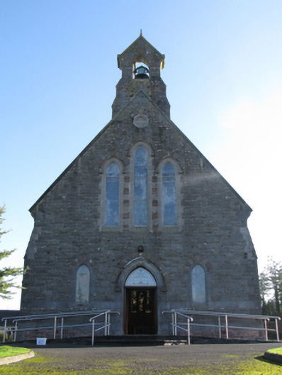 Catholic Church of Saint Peter and Saint Paulchurch/chapel · 188 yd
 Michael DavittMemorial · 268 yd
 Abbey in RuinsReligious house, Dominican friars · 269 yd
 IndicatedFairy fort / earthen ringfort · 947 yd
 Ballylahan Castle in RuinsCastle, Anglo-Norman masonry castle · 1.2 mi
 LismoreFairy fort / earthen ringfort · 1.2 mi
 Shonagawna Castle in RuinsCastle, unclassified · 1.9 mi
 Oak WoodWood · 4.0 mi
 Admiral William BrownMemorial · 4.1 mi
 Foxford Woollen MillsHeritage attraction · 4.1 mi
 National Museum of Ireland, Country LifeMuseum · 4.2 mi
 Sunken GardenWood · 4.3 mi
Other information
Photo: Credit not shown in the picture search · Rights wording not checked; contact us if this picture should be removed