
Places near here
Photo credits
- David Dixon, Wikimedia Commons · CC BY-SA 2.0
- Mike Faherty, Wikimedia Commons · CC BY-SA 2.0
- Mike Faherty, Geograph · CC BY-SA 2.0
- Eric Jones, Wikimedia Commons · CC BY-SA 2.0
- Kenneth Allen, Geograph · CC BY-SA 2.0
- Yvonne Wakefield, Wikimedia Commons · CC BY-SA 2.0
- Ashishkattoor, Wikimedia Commons · CC BY-SA 4.0
- Ross, Wikimedia Commons · CC BY-SA 2.0
- Anne Burgess, Wikimedia Commons · CC BY-SA 2.0
- Richard Webb, Geograph · CC BY-SA 2.0
 Church Of St. Patrick And St. BrigidChurch · 801 yd
Explorer Tom Church Of St. Patrick And St. Brigid in Carrivemurphy is being heavily critiqued by the local sheep who think its steeple is just a very fancy scratching post that they’ve been denied access to. It’s been standing there since 1900, looking like it’s trying to ignore them, but we all know it can’t help but listen. Pick a stone, any stone, and invent its biography.
Field System & EnclosuresField System & Enclosures, Booley Settlement · 1399 ydExplorer Tom Field System & Enclosures, BOOLEY SETTLEMENT in Bay; Carrivemurphy was where a matchmaker used to work and paired up everyone who wandered too close. She had a way with words that made even the rocks blush red. Stop the car, it's worth the hazard lights.
 Red ArchTunnel · 1.1 mi
Explorer Tom Red Arch in Red Bay is a tunnel that looks like it’s hiding from something, probably the light. Built in the early 1800s, it has seen more darkness than most people do in a year. If it rains, blame me; I said the weather was unpredictable here.
 Motte; two baileys; tower-house; curtain wall; possible site of promontory fort: red bay castle in Red BayMotte · 1.2 mi
Explorer Tom Red Bay Castle in Red Bay has two baileys, a tower-house, and maybe a promontory fort. That’s a lot of real estate for one castle to manage. Whisper a secret at it, it's kept worse.
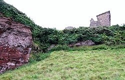 Red Bay CastleArchaeological place · 1.2 mi
Explorer Tom Red Bay Castle in County Antrim is in a massive drama with the nearest tree, arguing over who gets the best view of the sunset. It’s just ruins now, but it still carries itself like it owns the whole coastline and everyone else is just squatters. Bring a flask and pretend you own the place.
 LurigethanMountain / peak · 1.4 mi
Explorer Tom Lurigethan hosted a dance that went on so long the band quit from sheer boredom. Now it just stands there judging your questionable life choices from above. Dare you to say hello to it out loud.
 Ess-Na-Crub WaterfallWaterfall · 2.9 mi
Explorer Tom Ess-Na-Crub Waterfall would win any county fair prize for best splash sound or most dramatic tumble down the rocks. It practices every day, making sure it lands with a proper thud. Dare you to say hello to it out loud.
 Ess-na-Larach WaterfallWaterfall · 3.1 mi
Explorer Tom Ess-na-Larach is stuck in a fairy dispute over who gets to park their little cart by the base. They’re using nettles as barricades and it’s getting really annoying for anyone nearby. Mind the nettles, they're the real guards here.
 The White LadyNamed rock · 3.1 mi
Explorer Tom The White Lady has a curse that only affects people who don’t wave back when they pass by. She’s a rock shaped like a woman, so she’s got plenty of dignity and zero patience for rude pedestrians. Go back in winter, it's a different animal.
 Glenariff ForestWood · 3.3 mi
Explorer Tom If Glenariff Wood had Instagram, every post would just be a blurry selfie of a tree trunk with the caption 'vibes.' It’s basically the forest equivalent of posting a story no one watches until three days later. Ideal place to rehearse an excuse for being late.
May2007.jpg/250px-Tievebulliagh(AnneBurgess)May2007.jpg "Photo: Anne Burgess, Wikimedia Commons · CC BY-SA 2.0") TievebulliaghMountain / peak · 3.6 mi
TievebulliaghMountain / peak · 3.6 miExplorer Tom Tievebulliagh is a volcanic hill that made stone tools famous far beyond Antrim, and I am impressed because I can barely make a decent point with a pencil. At 402 metres it divides Glenaan from Glenballyemon. Heat from its basalt formed hard porcellanite, which Neolithic workers quarried for axe heads. Rough pieces were shaped here, finished nearer the shore and carried across Ireland and Britain, as far as the Outer Hebrides and southern England. Flakes and unfinished examples still tell the story of the work. I would offer to make one and quickly discover five thousand years of skill do not rub off in an afternoon. Check lawful hill access, keep off fragile quarry ground and leave every archaeological stone in place. This modest mountain once supplied a remarkably wide world.
 Millennium MilepostVisitor information · 4.7 mi
Explorer Tom Millennium Milepost on the coast road is deeply suspicious of the postman because he once delivered a letter addressed to 'The Pole' instead of it. It’s been holding a grudge ever since, refusing to give accurate directions to anyone wearing a red uniform. Have a chat with it, nobody's watching.
More archaeology and monuments in County Antrim · All of County Antrim

What do you know about this place?Tap to add a comment or ask a question