
What is recorded here
Recorded construction date: 1800 - 1819. Current recorded use: Tunnel.
From the Northern Ireland Historic Buildings Record record HB05/01/021
The official record and map point do not grant access. Many historic buildings are privately owned; view them only from public ground unless the owner allows entry.
Places near here
Photo credits
- Mike Faherty, Geograph · CC BY-SA 2.0
- Eric Jones, Wikimedia Commons · CC BY-SA 2.0
- Kenneth Allen, Wikimedia Commons · CC BY-SA 2.0
- Kenneth Allen, Geograph · CC BY-SA 2.0
- Anne Burgess, Wikimedia Commons · CC BY-SA 2.0
- Yvonne Wakefield, Wikimedia Commons · CC BY-SA 2.0
- Ashishkattoor, Wikimedia Commons · CC BY-SA 4.0
- N Chadwick, Geograph · CC BY-SA 2.0
- Ross, Wikimedia Commons · CC BY-SA 2.0
- Kateshortforbob, Wikimedia Commons · CC BY-SA 3.0
 Motte; two baileys; tower-house; curtain wall; possible site of promontory fort: red bay castle in Red BayMotte · 73 yd
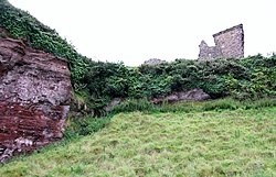 Red Bay CastleArchaeological place · 78 yd
 Central BarPublic House · 1.0 mi
 LurigethanMountain / peak · 1.0 mi
 Sundial HouseHouse · 1.1 mi
May2007.jpg/250px-Tievebulliagh(AnneBurgess)May2007.jpg "Photo: Anne Burgess, Wikimedia Commons · CC BY-SA 2.0") TievebulliaghMountain / peak · 3.1 mi
TievebulliaghMountain / peak · 3.1 mi The White LadyNamed rock · 3.3 mi
 Ess-Na-Crub WaterfallWaterfall · 3.8 mi
 Ess-na-Larach WaterfallWaterfall · 3.9 mi
 Caves of CushendunHeritage attraction · 4.0 mi
 Glenariff ForestWood · 4.2 mi
 Glenariff ForestForest · 4.4 mi
More historic places in County Antrim · All of County Antrim
What do you know about this place?