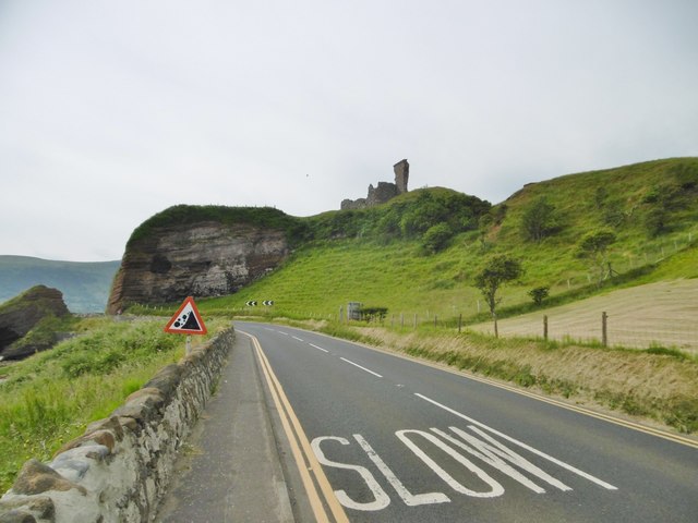
What is recorded here
Red Bay Castle in County Antrim layered a motte, two baileys, a tower-house and curtain wall above a possible promontory fort, marking the coast as a place of continuous defence rather than a single sudden build. Its medieval and later shapes suggest people kept returning to the same dangerous edge, adjusting stone and earth as threats changed. The sea may have tested the wall more often than armies did, forcing residents to read the water before reading the sky.
The official Northern Ireland record identifies this as MOTTE; TWO BAILEYS; TOWER-HOUSE; CURTAIN WALL; possible site of PROMONTORY FORT: RED BAY CASTLE. Recorded period: MEDIEVAL; LATE-MED; POST-MED; MED/L.MED. Recorded protection: Scheduled. The official map point was placed at the centre of the recorded archaeological site from the source map reference.
The monument record does not grant public access. Check the route and ask the landowner before entering private land.
- What survives
- Recorded monument
Places near here
 Red Bay CastleArchaeological place · 14 yd
 Red ArchTunnel · 73 yd
 A.P. SITEA.P. SITE, enclosure · 1216 yd
 ENCLOSURE in KnockenyENCLOSURE · 1302 yd
 Central BarPublic House · 1728 yd
 LurigethanMountain / peak · 1.0 mi
 The Glens of AntrimViewpoint · 1.0 mi
 HOUSE: OLD CASTLE in LaydHOUSE: OLD CASTLE · 2.0 mi
 TievebulliaghMountain / peak · 3.1 mi
 The White LadyNamed rock · 3.3 mi
 Ess-Na-Crub WaterfallWaterfall · 3.9 mi
 Ess-na-Larach WaterfallWaterfall · 4.0 mi
Other information
Photo: Mike Faherty · CC BY-SA 2.0