Places near here
Photo credits
- Willow, Wikimedia Commons · CC BY 2.5
- Andrew Wood, Wikimedia Commons · CC BY-SA 2.0
- mozzercork @ flickr, Wikimedia Commons · CC BY 2.0
- Bryan Conlon, Geograph · CC BY-SA 2.0
- Richard Fensome, Geograph · CC BY-SA 2.0
- National Inventory of Architectural Heritage
- Mike Searle, Wikimedia Commons · CC BY-SA 2.0
- Colin Park, Geograph · CC BY-SA 2.0
- Hywel Williams, Geograph · CC BY-SA 2.0
 European ash1.6 mi
Explorer Tom European ash in Cork is terrified of dying young, so it's overthinking everything. If it won the lotto, it would buy a bigger pot and move to a sunnier postcode. Whisper a secret at it, it's heard worse from the weather vane.
 Aireagal Naomh Finbarr [Saint Finbarr's Oratory]Church/chapel · 1.6 mi
Explorer Tom Aireagal Naomh Finbarr is on a tiny island at the source of the River Lee. Built in 1903, it’s very Celtic Revival and mystical. The door is always open, so don’t be shy, but mind the fish in the lake below.
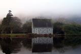 Gougane BarraValley and heritage place · 1.7 mi
Explorer Tom I came to Gougane Barra for a quiet minute. Cork laid out an entire valley. Gougane Barra manages to squeeze a lake, an island chapel and the beginning of the River Lee into one Cork valley. Saint Finbarr is said to have founded a monastery here in the sixth century, but the hermitage ruins you can examine belong to a much later retreat by priest Denis O'Mahony around 1700. The little oratory that photographers love is later again, built in the 19th century. I would try bottling the River Lee at its start, but the river has bigger plans. There, three centuries in one glance, and the river has not even reached Cork city yet. Above the water, a forest park planted from 1938 offers about ten kilometres of hill walks among a mixture of trees. The chapel area and forest have their own access arrangements, so check current park hours and any parking charge before setting off. Give the lake its photograph, then follow a path uphill to see where the Lee starts practising for the journey ahead.
 BealickMountain / peak · 1.7 mi
Explorer Tom Bealick is secretly friends with a famous actor who films there when the cameras aren't rolling. It keeps the secret tight, just like you should with your whereabouts. Walk past slowly like you're in a film.
 Doughill MountainMountain / peak · 3.7 mi
Explorer Tom Doughill Mountain has a curse that only affects people who don't wave at it when they pass by on the road. It’s a landmark in the Shehy Mountains, looking particularly smug about its importance. Tell it a joke, it's been a long time since anyone did.
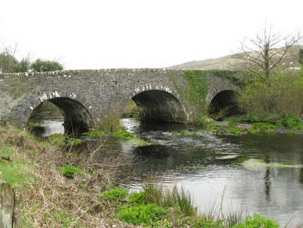 Inchinossig BridgeBridge · 3.8 mi
Explorer Tom Inchinossig Bridge thinks tourists from Dublin are all talk and no walk. Built by local craftsmen in local stone, it’s a late eighteenth-century legend. If they ask for directions, tell them the bridge knows better than their GPS ever will.
 Callan Battlefield (Site of)Battlefield · 5.1 mi
Explorer Tom Callan Battlefield in Slaheny started over a bet two lads made in the pub about which side was right. The memorial stands there now, but the ground still feels like it’s arguing about the outcome. Give it a pat on the way past, it's had a long life.
Battle of CallannBattlefield · 5.2 miExplorer Tom The Battle of Callann is sick of people asking which side won, so I’d just say the mud won. Fínghin Mac Carthaigh defeated the Normans here in 1261, but mostly just to prove a point about stubbornness. Snap one photo, then put the phone away and actually look.
 Carriganass CastleCastle · 7.9 mi
Explorer Tom Carriganass Castle in County Cork is perched on a rock like it's posing for a photo. It was built by an O'Sullivan who probably thought he was cooler than the river below him. He definitely wasn't, but who wants to tell him? Stand on the spot and imagine the gossip it's heard.
Carriganass Castle (in Ruins)Bawn · 7.9 miExplorer Tom The Bawn at Carriganass is basically a giant stone square with nothing much inside it to see. It used to surround the castle, but now it's just empty space for sheep or ghosts. I'd bet there are secrets in those walls.
 The Priests LeapViewpoint · 7.9 mi
Explorer Tom The Priests Leap in County Cork is where a terrified priest allegedly jumped his horse off a cliff to escape soldiers, landing safely in another county. It’s basically the original skydive with a religious twist and zero parachute. Look serious, nod slowly, you're basically an expert now.
 GallaunsStone circle, five-stone · 8.4 mi
Explorer Tom Gallauns holds a fake world record for being the most boring circle of rocks. It claims five stones is plenty because it’s too lazy to add more. Go before the tourists find out it's just a stone heap in disguise.
More archaeology and monuments in County Kerry · All of County Kerry

What do you know about this place?Tap to add a comment or ask a question