
What is recorded here
From the National Monuments Service (Archaeological Survey of Ireland) record CO106-006001
The monument record does not grant public access. Check the route and ask the landowner before entering private land.
- What survives
- Recorded monument
Places near here
 Kealkill stone circleVisitor information · 72 yd
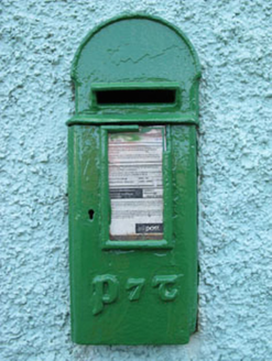 post box895 yd
 Carriganass BridgeBridge · 1233 yd
 Carriganass CastleCastle · 1250 yd
 Graveyard1.3 mi
 Ballylickey BayBay · 3.9 mi
 Coomhola MountainMountain / peak · 4.3 mi
 Chilean myrtle4.6 mi
 Japanese cedar4.9 mi
 Nowen Hill sw TopMountain / peak · 5.1 mi
 Castle Donovan (in Ruins)Castle, tower house · 5.2 mi
 The Priests LeapViewpoint · 5.4 mi
Pictures: Mike Searle, Geograph · CC BY-SA 2.0; National Inventory of Architectural Heritage; MrCorman, Wikimedia Commons · CC BY-SA 4.0; Mike Searle, Wikimedia Commons · CC BY-SA 2.0; Mac McCarron, Geograph · Creative Commons Attribution-ShareAlike 2.0; N Chadwick, Geograph · CC BY-SA 2.0; Richard Webb, Geograph · CC BY-SA 2.0; Draceane, Wikimedia Commons · CC BY-SA 4.0; Yosemite, Wikimedia Commons · CC BY-SA 3.0; Ernest Riordan, Geograph · CC BY-SA 2.0; Graham Horn, Geograph · CC BY-SA 2.0; Colin Park, Geograph · CC BY-SA 2.0
More archaeology and monuments in County Cork · All of County Cork
What do you know about this place?