
What is recorded here
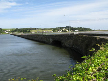
Rubble stone causeway, built c.1860, running along the eastern side of Rosscarbery Bay. Asphalt paving with vertically stacked rubble stone walls. Single round-headed arch with rubble stone voussoirs and parapets.
An integral part of Rosscarbery Bay, this causeway makes it possible to access different parts of the bay despite fluctuations in water level. Utilitarian in purpose and design, this causeway demonstrates excellent local stone craftsmanship.
From the Buildings of Ireland (National Inventory of Architectural Heritage) record 20914307
This does not grant access. Most recorded buildings are privately owned; view them only from public ground unless the owner allows entry.
Places near here
Photo credits
- National Inventory of Architectural Heritage
- Owen O'Sullivan, Geograph · CC BY-SA 2.0
- Andreas F. Borchert, Wikimedia Commons · CC BY-SA 4.0
- Caitlin Ferguson-Mir, Wikimedia Commons · CC BY-SA 2.0
- Draceane, Wikimedia Commons · CC BY-SA 4.0
- Mike Searle, Wikimedia Commons · CC BY-SA 2.0
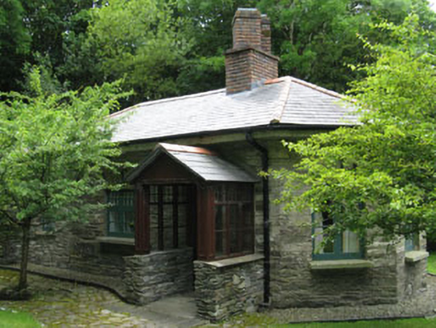 Creggane ManorGate lodge · 535 ydThe WarrenBeach / strand · 658 yd
 bridge838 ydMan-made underground passage in BurgatiaMan-made underground passage · 858 yd
 Downeen Castle (in Ruins)Castle, tower house · 1156 yd
 St Fachtnas CathedralCathedral · 1287 yd
 Ownahincha Strand (West)Beach / strand · 1525 ydPol a Dabh West (Blowhole)Viewpoint · 1.2 miLookout over MillcoveViewpoint · 1.3 mi
 Chilean myrtle1.9 miChilean myrtle1.9 mi
 Coppingers CourtCastle · 2.0 mi
More historic places in County Cork · All of County Cork
What do you know about this place?