What is recorded here
Situated on a gentle S-facing slope, c. 500m N of the point where the Tay River enters the sea at Stradbally Cove. References to the borough of Stradballydouyn or Stradballycolgyn are very few and date from the late 13th century to the mid-14th century. It was held partly by the FitzGeralds of Desmond, but it appears that the family of Thomas de Denne also held a portion of the town and some tennants held directly of the King. Although the town and its burgesses are not mentioned after 1382, the settlement seems to have survived as it is described as a country town with a great many houses in the Civil Survey of c. 1655 (Simington 1942, 73) and it returned a population of 30 persons in 1659 (Pender 1939, 336). The location of the settlement is not known with certainty, but it may have been around the church (WA032-012001-), and the street may have been the road extending E from it. It is possible that the village was re-settled in its present form in the 17th or 18th century. A kiln (WA032-012004-) recovered in archaeological testing c. 80m N of the church may be associated with the medieval settlement (Noonan 2004, 495). In 2018 a large quantity of medieval pottery dating to the 13th/14th century, including Leinster cooking ware and Saintonge, was identified during field walking in a forestry plantation on the S edge of Stradbally and c. 200m SE of Stradbally church (WA032-012001-) suggesting the medieval settlement extended S of the modern village (pers. comm. Dave Pollock, 20 July 2018). The date of the pottery supports the documentary evidence that the medieval settlement was thriving during this period. (Bradley et al. 1989, 106-08)
See attached note on the medieval pottery by Pollock, 20 July 2018
The above description is derived from the published 'Archaeological Inventory of County Waterford' (Dublin: Stationery Office, 1999).
Situated on a gentle S-facing slope, c. 500m N of the point where the Tay River enters the sea at Stradbally Cove. References to the borough of Stradballydouyn or Stradballycolgyn are very few and date from the late 13th century to the mid-14th century. It was held partly by the FitzGeralds of Desmond, but it appears that the family of Thomas de Denne also held a portion of the town and some tennants held…
From the National Monuments Service (Archaeological Survey of Ireland) record WA032-012
The monument record does not grant public access. Check the route and ask the landowner before entering private land.
- What survives
- Recorded monument
Places near here
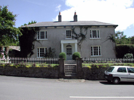 GlenamaraHouse · 32 yd
 KnockardHouse · 38 yd
 Stradbally CoveBeach / strand · 821 ydToberkilleagh WellHoly well · 932 ydCastle (in ruins)Castle, unclassified · 1.5 miGrange WellSpring · 2.4 miChurch (in ruins)Castle, unclassified · 2.4 mi
 Ballydowane CoveBeach / strand · 2.4 mi
 CastleStructure · 3.6 miTrá na mBóVisitor information · 3.7 mi
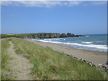 Bunmahon StrandBeach / strand · 4.1 mi
 Copper CoastCoastal geological landscape · 4.2 mi
Pictures: National Inventory of Architectural Heritage; John M, Geograph · CC BY-SA 2.0; ethics girl, Geograph · CC BY-SA 2.0; Robert French, Wikimedia Commons · Public domain; Jonathan Thacker, Geograph · CC BY-SA 2.0; Veekrokki, Wikimedia Commons · Public domain
More archaeology and monuments in County Waterford · All of County Waterford
What do you know about this place?