Places near here
Photo credits
- National Inventory of Architectural Heritage
- Kenneth Allen, Wikimedia Commons · CC BY-SA 2.0
- Andreas F. Borchert, Wikimedia Commons · CC BY-SA 4.0
- Kenneth Allen, Geograph · CC BY-SA 2.0
- Richard Webb, Wikimedia Commons · CC BY-SA 2.0
 bridge418 yd
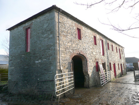
Explorer Tom Bridge in Gortaquigley probably let a farmer cross the narrow gauge railway. Its arch once had trains passing beneath; the track was removed around 1960. Now the train is missing and the bridge keeps its arch. I wonder if it misses the noise.
 Church of Ireland Bishop’s PalaceBishop's palace · 949 yd
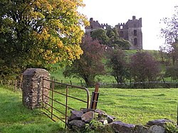
Explorer Tom Church of Ireland Bishop’s Palace stands as a brooding ruin, having been deliberately burnt in c. 1838 by a man who wanted a cheaper lease on the demesne. It is perfect for spotting four corner towers that make it look far more like an Italian fortress than a clergyman's home, especially when you notice the Latin inscription dating back to 1636.
 PalaceHouse, fortified house · 950 yd
Explorer Tom The Palace in Raphoe Demesne is a ghost with a very specific birth year of 1637. Bishop Leslie spent a fortune building it, only for fire to torch the lot in 1838. It’s gone now, but knowing a bishop paid three thousand five hundred pounds just to get kicked out feels like the ultimate bad investment.
 Raphoe Cathedral Carved LintelStone sculpture · 1086 yd
Explorer Tom Raphoe Cathedral Carved Lintel holds a ninth-century snapshot of the Arrest in the Garden, with St. Peter slashing an ear while Malchus yelps. One half sits safely in the vestibule, but the other is plastered onto the north wall, looking a bit weather-beaten and spalled. It’s like finding a medieval selfie stick out of the dark ages.
 Cathedral in Raphoe TownparksCathedral · 1089 yd
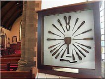
Explorer Tom Cathedral in Raphoe Townparks hides a 9th-century lintel right under your nose. It depicts St. Peter chopping an ear off, which is a bit of a violent detail for a church entrance, but it proves this spot has been holy chaos for over a millennium.
 Diamond BarPub · 1165 yd
Explorer Tom Diamond Bar in Raphoe would tell a job interviewer it has excellent customer service and a slight smell issue. It sits at the north end of The Diamond Square. Bring a map, get lost anyway, that's the fun.
 Oakfield ParkPark · 1.1 mi
Explorer Tom Oakfield Park in Donegal once had a resident matchmaker who knew every single heartbreak and happy ending happening within its shady, leafy boundaries without missing a beat. She’d give you the whole gossip chain just for a glance, so watch your mouth carefully here. Pack a picnic and an excuse.
 Mongorry HillMountain / peak · 2.2 mi
Explorer Tom Mongorry Hill swears by a superstition that says if you sneeze, you must buy a pint or it will rain all week. Locals are terrified of this rule, so they carry umbrellas even in sunshine just to be safe. Whisper a secret at it, because it has kept worse ones for centuries.
 Carnowen HillMountain / peak · 2.8 mi
Explorer Tom Carnowen Hill has a secret it would tell after a few pints, but it never gets drunk because it’s too busy watching the sun set. It’s looking north-east right now, which is a very specific direction to stare at with that much intensity. Find a local and ask them the real story, then come back and tell me.
 Battlefield in Tully (kincraigy Ed),glenmaquin Lower,roosky (castleforward Ed)Battlefield · 3.7 mi
Explorer Tom Tully, Glenmaquin Lower had a fox that took charge of the whole operation once, probably because it was smarter than the generals involved in the mess. The animal just sat on a rock looking smug while everyone else argued over who started it. Take the long way round, it deserves the effort.
Battle of GlenmaquinBattle · 4.1 miExplorer Tom Battle of Glenmaquin would tell its younger self to stop caring so much about the Crown victory and just enjoy the mud, because 1642 was all about the mess anyway. It’s part of the Irish Confederate Wars, which sounds like a very exclusive club that nobody wanted to join voluntarily. Look serious, nod slowly, you're basically an expert now.
 McBride’s BarPub · 4.4 mi
Explorer Tom McBride’s Bar is looking south at Sandy Road, which sounds like a beach but feels like a trap set by gulls. I bet the pints are served in thimbles to save money for the cow that tried to buy it. Mind the nettles, they're the real guards here.
More historic places in County Donegal · All of County Donegal

What do you know about this place?Tap to add a comment or ask a question