
Places near here
Photo credits
- National Inventory of Architectural Heritage
- Kenneth Allen, Wikimedia Commons · CC BY-SA 2.0
- Kenneth Allen, Geograph · CC BY-SA 2.0
- Andreas F. Borchert, Wikimedia Commons · CC BY-SA 4.0
- Richard Webb, Wikimedia Commons · CC BY-SA 2.0
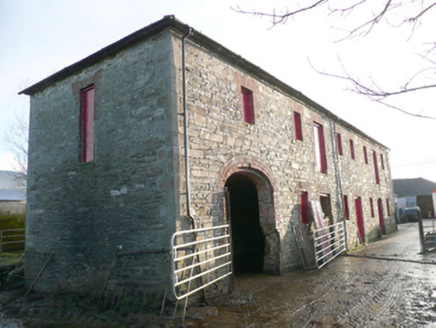 store/warehouse418 yd
Explorer Tom Store or warehouse in Magherahaan has a whole staircase just for the first floor. Built c. 1860, I think the flax got too arrogant to walk in through the front door and demanded its own VIP entrance. Did it want to avoid the mud?
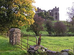 Church of Ireland Bishop’s PalaceBishop's palace · 701 yd
Explorer Tom Church of Ireland Bishop’s Palace stands as a brooding ruin, having been deliberately burnt in c. 1838 by a man who wanted a cheaper lease on the demesne. It is perfect for spotting four corner towers that make it look far more like an Italian fortress than a clergyman's home, especially when you notice the Latin inscription dating back to 1636.
 PalaceHouse, fortified house · 702 yd
Explorer Tom The Palace in Raphoe Demesne is a ghost with a very specific birth year of 1637. Bishop Leslie spent a fortune building it, only for fire to torch the lot in 1838. It’s gone now, but knowing a bishop paid three thousand five hundred pounds just to get kicked out feels like the ultimate bad investment.
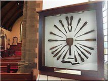 Cathedral in Raphoe TownparksCathedral · 839 yd
Explorer Tom Cathedral in Raphoe Townparks hides a 9th-century lintel right under your nose. It depicts St. Peter chopping an ear off, which is a bit of a violent detail for a church entrance, but it proves this spot has been holy chaos for over a millennium.
 Raphoe Cathedral Carved LintelStone sculpture · 841 yd
Explorer Tom Raphoe Cathedral Carved Lintel holds a ninth-century snapshot of the Arrest in the Garden, with St. Peter slashing an ear while Malchus yelps. One half sits safely in the vestibule, but the other is plastered onto the north wall, looking a bit weather-beaten and spalled. It’s like finding a medieval selfie stick out of the dark ages.
 Diamond BarPub · 947 yd
Explorer Tom Diamond Bar in Raphoe would tell a job interviewer it has excellent customer service and a slight smell issue. It sits at the north end of The Diamond Square. Bring a map, get lost anyway, that's the fun.
 Oakfield ParkPark · 1625 yd
Explorer Tom Oakfield Park in County Donegal smells like a mixture of wet dog, old rubber, and the faintly sweet scent of regret from all the picnics that went wrong here over the last few decades without anyone cleaning up their messes properly afterwards. It is a unique aroma that you can only truly appreciate if you close your eyes and really
 Mongorry HillMountain / peak · 2.1 mi
Explorer Tom Mongorry Hill is having a bit of an identity crisis, probably because 'Mongorry' sounds like a dog that stole your sandwich. It’s just sitting there being a peak in County Donegal. Perfect detour when the satnav has a meltdown.
 Carnowen HillMountain / peak · 3.1 mi
Explorer Tom Carnowen Hill in County Donegal is the subject of constant seagull gossip, with them whispering about whether it’s peaked or just a big mound. They’re not sure either. Look serious, nod slowly, you're basically an expert now, don't overthink the bird chatter.
 Battlefield in Tully (kincraigy Ed),glenmaquin Lower,roosky (castleforward Ed)Battlefield · 3.5 mi
Explorer Tom Battlefield in Tully, Glenmaquin Lower, Roosky is a patch of earth that remembers being trampled by very angry people. It's quiet now, but the ground still feels like it's holding its breath. Stand where the owner stood and practise looking smug about your discovery.
Battle of GlenmaquinBattle · 4.0 miExplorer Tom The seagulls at Glenmaquin say the Battle of 1642 was mostly about who got the best sandwich first. Very political, very messy. Toast it with a cup of tea and move on to the next spot before you start overthinking the whole thing.
 Castle in Town Parks of StrabaneCastle · 5.8 mi
Explorer Tom This castle in Strabane Town Parks would tell you in a job interview that it has excellent stability and long-term potential. It’s sitting quietly in the park, watching over the spot where a cycle shop used to be. Bring a camera and your most suspicious face.
More historic places in County Donegal · All of County Donegal

What do you know about this place?Tap to add a comment or ask a question