What is recorded here
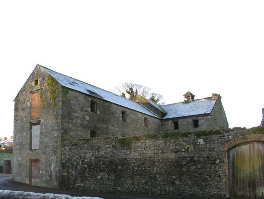
Store or warehouse in Townplots West has a loading door bricked shut while others survive upstairs, the sort of arrangement that turns ‘Your delivery is here’ into ‘How good is your throwing arm?’
Grain store or warehouse complex, extant 1838, including: Attached single-bay (three-bay deep) three-storey gable-fronted grain store or warehouse on a rectangular plan. Now disused. Pitched (gable-fronted) slate roof on timber construction with clay ridge tiles, and no rainwater goods surviving on exposed timber rafters. Part creeper- or ivy-covered coursed rubble limestone walls with cut-limestone flush quoins to corners. Square-headed loading door openings to front (east) elevation with hammered limestone (ground floor) or timber (remainder) lintels framing timber boarded doors with one having red brick Common bond infill. Square-headed window openings with timber lintels on yellow brick imposts framing timber fittings having wrought iron bars. Street fronted on a corner site with coursed rubble limestone boundary wall to perimeter having creeper- or ivy-covered coping.
A grain store or warehouse complex surviving as an interesting relic of the industrial heritage of Killala following the decline 'of its old time commercial prosperity…since the improvements to the channel allowed ships to proceed upstream to Ballina Quay' (ITA 1943). A prolonged period of neglect notwithstanding, the elementary form and massing survive intact together with quantities of the historic or original fabric, thus upholding the character or integrity of a grain store or warehouse complex making a pleasing visual statement overlooking Killala Bay: meanwhile, a much-weathered benchmark remains of additional interest for the connections with cartography and the preparation of maps by the Ordnance Survey (established 1824).
From the Buildings of Ireland (National Inventory of Architectural Heritage) record 31203008
This does not grant access. Most recorded buildings are privately owned; view them only from public ground unless the owner allows entry.
Places near here
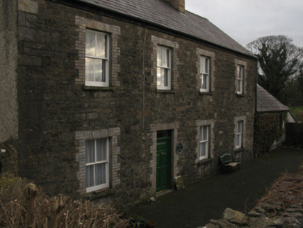 The CloseHouse · 32 yd
 Cathedral in Townplots WestCathedral · 72 ydSaint Patrick's Cathedral (Killala)Cathedral · 72 yd
 Round tower in Townplots WestRound tower · 145 yd
 Battle of KillalaBattle · 193 yd
 Rinnaun PointHeadland · 1699 yd
 Moyne AbbeyHeritage attraction · 1.9 mi
 Rosserk AbbeyHeritage attraction · 4.2 mi
 Enniscrone BeachBeach / strand · 4.2 mi
 Hawthorn4.2 mi
_-_geograph.org.uk_-_4073208.jpg/250px-Castles_of_Connacht,_Rathroe,_Mayo_(1)_-_geograph.org.uk_-_4073208.jpg "Photo: Mike Searle, Wikimedia Commons · CC BY-SA 2.0") Rathroe CastleCastle · 4.4 mi
Rathroe CastleCastle · 4.4 mi CastleCastle, unclassified · 4.5 mi
Pictures: National Inventory of Architectural Heritage; Andreas F. Borchert, Wikimedia Commons · CC BY-SA 4.0; JohnArmagh, Wikimedia Commons · CC BY-SA 3.0; Edward S. Siebert, Wikimedia Commons · Public domain; Steve Edge, Geograph · CC BY-SA 2.0; Robin Mais, Geograph · CC BY-SA 2.0; Didier Descouens, Wikimedia Commons · CC BY-SA 4.0; Mike Searle, Wikimedia Commons · CC BY-SA 2.0; Mike Searle, Geograph · CC BY-SA 2.0
More historic places in County Mayo · All of County Mayo
What do you know about this place?