
What is recorded here
Stone row described by O'Hare (1996, 10) as consisting of; 'three stones, one of which is lying prostrate. A short distance west of the monument, the field of pasture in which it stands, slopes away to the north, south and west. The site commands a fine view over the Paps Mountains to the south. In the distance…
Read the whole record
From the National Monuments Service (Archaeological Survey of Ireland) record KE049-108
Places near here
Photo credits
- Maker not stated on source page, in.pinterest.com
- Maker not stated on source page, www.pinterest.com
- Maker not stated on source page, en.wikipedia.org
- Maker not stated on source page, www.flickr.com
- Maker not stated on source page, za.pinterest.com
- Maker not stated on source page, nexusnewsfeed.com
- Maker not stated on source page, tr.pinterest.com
- National Inventory of Architectural Heritage
- Kmcnamee, Wikimedia Commons · CC BY-SA 4.0
 Stone row in ToornanaunaghStone row · 1398 yd
Explorer Tom Stone row in Toornanaunagh is three stones where two have given up and are lying down flat. In a job interview, they'd…
 Fairy fort / earthen ringfort in Knockrower EastFairy fort / earthen ringfort · 1401 yd
Explorer Tom Fairy fort / earthen ringfort in Knockrower East is currently being reviewed by local seagulls who say it’s 'a bit…
 Stone circle in Ballahantouragh (trughanacmy By., Carker Ed)Stone circle · 1.3 mi
Explorer Tom Stone circle in Ballahantouragh was overturned by people searching for gold that probably wasn't there. It’s a bit like…
 Fairy fort / earthen ringfort in ToornanaunaghFairy fort / earthen ringfort · 1.3 mi
Explorer Tom Fairy fort / earthen ringfort in Toornanaunagh was found because a fox walked through it like it owned the place. The…
 Fairy fort / earthen ringfort in CarkerFairy fort / earthen ringfort · 1.5 mi
Explorer Tom Carker’s other fort offers a shortcut that isn’t really a shortcut at all, just a walk in circles. It’s perfect for…
Fairy fort / earthen ringfort in Knockrower WestFairy fort / earthen ringfort · 1.7 miExplorer Tom Fairy fort / earthen ringfort in Knockrower West hosted a fake royal visit last Tuesday, complete with a crown made of…
 Fairy fort / earthen ringfort in GortacappulFairy fort / earthen ringfort · 2.4 mi
Explorer Tom Another Fairy fort / earthen ringfort in Gortacappul thinks it’s a celebrity but has no press agent. It would say “I’m…
 Standing stone in MaulyarkaneStanding stone · 3.5 mi
Explorer Tom The Vikings got hopelessly lost searching for this irregular slab on a plateau. They likely assumed it was a giant…
 Tobar na bhFionn CemeteryGraveyard · 4.7 mi
Explorer Tom Tobar na bhFionn Cemetery is where Saint Patrick supposedly stopped to complain about the mud before deciding it was…
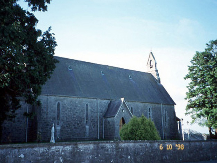 Catholic Church of the Immaculate ConceptionChurch/chapel · 4.8 mi
Explorer Tom Catholic Church of the Immaculate Conception in Cordal West thinks Dublin tourists are just noisy pigeons with…
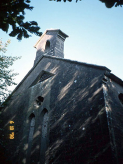 Cordal Church (Ballincuslane)Church/chapel · 4.9 mi
Explorer Tom Cordal Church in Ballincuslane is secretly proud of one very specific potato in its field. It’s Gothic and grand, but…
 Cordal GAA pitchGAA ground · 5.0 mi
More archaeology and monuments in County Kerry · All of County Kerry

What do you know about this place?Tap to add a comment or ask a question