DDiscover AloneMapAbout

Stone circle in Rahugh

Stone circle
Computer-made picture that does not show Stone circle in RahughNot a photo of this monument
Computer-made picture. It does not show this monument. · Report the wrong picture

What is recorded here

Unlocated possible stone circle in the townland of Rahugh. The monument was described in 1870-1 as following; 'There are the remains of a stone circle in Rath-hugh, from which all the stones have been removed except seven, and of these one only remains perpendicular. ' They are grits,' said a man who came towards me…

Read the whole record
Unlocated possible stone circle in the townland of Rahugh. The monument was described in 1870-1 as following; 'There are the remains of a stone circle in Rath-hugh, from which all the stones have been removed except seven, and of these one only remains perpendicular. ' They are grits,' said a man who came towards me as I went along chipping them with a hammer. ' And there is a stone standing alone in the Sally meadow; and I heard them say that there used to be another over near the hills.' The circle was about thirty yards in diameter. It is upon a sloping ground which looks to the beautiful towering moat (WM038-045----), distant a quarter of a mile, and due east of it. Perhaps some of the stones of the circle were removed by the builders of the old church (WM038-041----) the cyclopean-like ruin hard by. Boulders appear through the turf, where the circle was continued, but I cannot think that they formed a part of it. The stone in the meadow is triangular in a rough way ; its apex may be about five feet above the earth ; it is flatsided, and ranged within a few degrees of the meridian. My friend, Mr. John Deane, told me that roadmakers were prevented from encroaching upon the stone circle by old Mr. Bagnal. When I saw it, the sandpit was grass-grown, or mossgrown,and two or more of the stones had tumbled into it' (Anon 1878, 27-8). Anon (1878) 'Proceedings', Journal of the Royal Historical and Archaeological Association of Ireland 1870-71, Vol. 1, 27-8.

From the National Monuments Service (Archaeological Survey of Ireland) record WM038-058

The monument record does not grant public access. Check the route and ask the landowner before entering private land.

What do you know about this place?Tap to add a comment or ask a question

What you write will be public.

Places near here

Photo credits
  • Trenchspike, Wikimedia Commons · CC BY-SA 4.0
  • National Inventory of Architectural Heritage
  • Picture: Heritage in Schools
  • Picture: offaly.gaa.ie
  • JP, Geograph · CC BY-SA 2.0
  • Willow, Wikimedia Commons · CC BY 2.5
  • Kieran Campbell, Geograph · Creative Commons Attribution-ShareAlike 2.0
  • Kieran Campbell, Wikimedia Commons · CC BY-SA 2.0
Lowertown BridgeBridge · 669 yd

Explorer Tom Lowertown Bridge is suspicious of the postman because he keeps walking on its back without asking permission, which is…
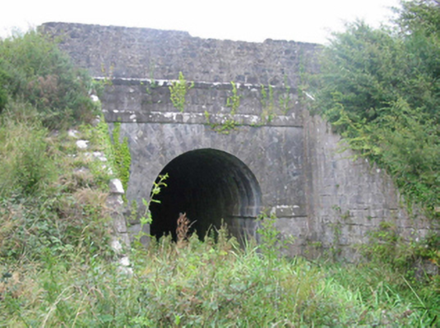
aqueduct931 yd

Explorer Tom Aqueduct in Lowertown is probably having a secret friendship with some famous celebrity who visits when nobody else is…
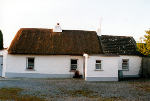
farm house1002 yd

Explorer Tom Farm house in Bracklin Little is a thatched farmhouse with its front door stuck at one end, which is a bit like living…
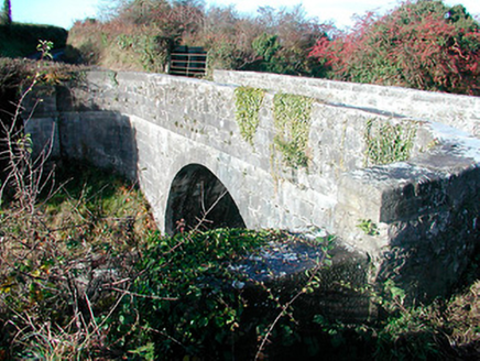
Grange BridgeBridge · 1618 yd

Explorer Tom Grange Bridge in Grange and Kiltober used to be the spot where a fiddler played until sunrise, mesmerizing the canal…

Ardan WoodWood · 1.5 mi

Explorer Tom Ardan Wood, near Sonnagh in County Westmeath, has been minding its own business for centuries, which is more than I can…

Saint Hugh's Catholic ChurchChurch/chapel · 1.6 mi

Explorer Tom Saint Hugh's Catholic Church in Montrath was saved by a hero nobody remembers anymore, probably just a guy with a good…

Durrow GAA pitchGAA ground · 3.3 miGrand Canal WayWalking route · 4.2 mi

Explorer Tom Grand Canal Way is handling its nosy neighbors by just keeping its eyes on the water, pretending it doesn’t see anyone…

European ash4.7 mi

Explorer Tom This European ash in County Offaly is hiding a scandal about which branch grew first, and nobody agrees. It keeps the…

Graveyard5.9 mi

Explorer Tom Graveyard in Kilbride is locked in a feud with the view over who gets to be photographed first. St Brigid’s well is…

Ballycowan CastleCastle · 6.5 mi

Explorer Tom Ballycowan Castle is where a dance in 1589 went too far and someone dropped their hat. It’s got a coat of arms on the…

Ballycowan Castle (in ruins)House, fortified house · 6.5 mi

Explorer Tom Ballycowan Castle in Ballycowan is a five-storey fortified house that looks like it’s watching you from across the…

More archaeology and monuments in County Westmeath · All of County Westmeath

Add to this placeAdd a picture Add a detailed tip Add a story

Explore the map1,095,414 places to discover

Next place · or swipeLowertown Bridge