
Places near here
Photo credits
- National Inventory of Architectural Heritage
- Richard Webb, Geograph · CC BY-SA 2.0
- N Chadwick, Geograph · Creative Commons Attribution-ShareAlike 2.0
- Mike Searle, Wikimedia Commons · CC BY-SA 2.0
- Jonathan Billinger, Geograph · CC BY-SA 2.0
- John M, Geograph · CC BY-SA 2.0
- Peter Ribbans, Wikimedia Commons · CC BY-SA 2.0
 farm house564 yd
Explorer Tom Ballycommane Farm house describes itself as a long, low landmark that’s basically a domestic and outbuilding hybrid.…
 Derrylahard EastMountain / peak · 1.6 mi
Explorer Tom Derrylahard East claims the local inventor made it out of leftover clay from a failed pottery class, but the trees…
 Sacred Heart Roman Catholic ChurchChurch/chapel · 2.4 mi
Explorer Tom Sacred Heart Roman Catholic Church in Carrig is showing off its craftsmanship like it just won a prize for best…
 St. James' ChurchChurch/chapel · 2.6 mi
Explorer Tom St. James' Church in Carrigboy has been rebuilt so many times it’s confused about its own age. The 1832 bell tower is…
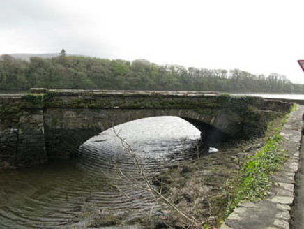 bridge2.6 mi
Explorer Tom Bridge in Clashadoo is a single-arch limestone structure from 1830 spanning a stream. It’s got dressed ashlar voussoirs…
 rectory/glebe/vicarage/curate's house2.7 mi
Explorer Tom Rectory in Clashadoo, County Cork is a former glebe house from around 1820. It used to be part of a church complex, so…
 Durrus LodgeCountry house · 3.0 mi
Explorer Tom Durrus Lodge in Ardogeena is hiding a scandal involving a chandelier that fell into a soup tureen during the 1890s…
 Mount CorrinMountain / peak · 3.6 mi
Explorer Tom Mount Corrin in County Cork would tell a teenager that the 1800s were basically just everyone complaining about their…
 Rossmore Castle (in Ruins)Castle, tower house · 3.7 mi
Explorer Tom Rossmore Castle has a plan for retirement that involves being slowly eaten by ivy until it becomes one with the…
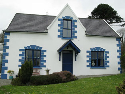 Rossmore LodgeHouse · 4.0 mi
Explorer Tom Rossmore Lodge was built for Lord Bandon’s manager around 1840 with sea views. It’s got gabled bays and conservatories…
 Garinish WestIslet · 6.3 mi
Explorer Tom Garinish West was once offered to a cow who wanted to buy it with a very shiny hoof, but the paperwork got lost in a…
 Ballycrovane Ogham StoneVisitor attraction · 21 mi
Explorer Tom The Ballycrovane Ogham Stone claims King Arthur once leaned on it while complaining about his back, which nobody can…
More archaeology and monuments in County Cork · All of County Cork

What do you know about this place?Tap to add a comment or ask a question