
What is recorded here
From the National Monuments Service (Archaeological Survey of Ireland) record CO150-060
Places near here
Photo credits
- Mac McCarron, Geograph · Creative Commons Attribution-ShareAlike 2.0
- National Inventory of Architectural Heritage
- Maker not stated on source page, thejournalofantiquities.com
- George Victor Du Noyer MRIA (1817 – 3 January 1869), Wikimedia Commons · Public domain
- Mick Garratt, Geograph · CC BY-SA 2.0
- Maker not stated on source page, www.pinterest.com
- Maker not stated on source page, www.flickr.com
- Maker not stated on source page, rockart.scot
- Maker not stated on source page, uk.pinterest.com
- Martin Southwood, Geograph · CC BY-SA 2.0
- Maker not stated on source page, extra.ie
 Shour WellHoly well · 1104 yd
Explorer Tom Shour Well in Highfield is right by the road near Lough Hyne, looking very official with its white wall. There are…
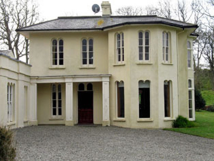 Lough Ine HouseHunting/fishing lodge · 1234 yd
Explorer Tom Lough Ine House in Ballyisland was Lord Carbery’s hunting lodge, so expect the ghosts to be wearing tweed and smelling…
 Cupmarked stone in BallyislandCupmarked stone · 1326 yd
Explorer Tom Ballyisland has a bedrock with two tiny cupmarks that look like someone spilled their tea. Find a local and ask them…
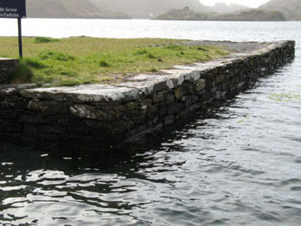 quay/wharf1340 yd
Explorer Tom Quay or wharf in Ballyoughtera is part of Lough Hyne's nature reserve and was built to help boats that definitely…
 Cloghan Castle (in Ruins)Castle, tower house · 1659 yd
Explorer Tom Cloghan Castle on Castle Island is just a corner of tower standing on a mound now. The O Driscolls built it, but it…
 KnockomaghMountain / peak · 1679 yd
Explorer Tom Knockomagh thinks tourists from Dublin are all wind and no substance, so keep your voice down near the summit. It’s got…
 Castle IslandIsland · 1744 yd
Explorer Tom Castle Island in County Cork is where Father Flaherty lost a bet about whether he could drink a pint in one go without…
 Metalworking site in Castle Island (carbery West (e.d.) By.)Metalworking site · 1.0 mi
Explorer Tom Metalworking site in Castle Island By.) is a rectangular structure of stone slabs that looks like a coffin for a very…
 Cupmarked stone in Castle Island (carbery West (e.d.) By.)Cupmarked stone · 1.0 mi
Explorer Tom Castle Island’s cupmarked rock has a secret talent for making perfect little dints that look like craters. It sits by…
 Cupmarked stone in BarnabahCupmarked stone · 1.0 mi
Explorer Tom Cupmarked stone in Barnabah is sitting on the shore, rolling its eyes at the terrible road that leads to it, which is…
 Bullock IslandIslet · 1.5 mi
Explorer Tom Bullock Island holds a fake world record for being the most ignored islet in County Cork, which is honestly a bit…
 An GeocánBeach / strand · 2.2 mi
Explorer Tom An Geocán was once played on all night by a fiddler who got lost and just kept going until dawn. The waves now have a…
More archaeology and monuments in County Cork · All of County Cork

What do you know about this place?Tap to add a comment or ask a question