
What is recorded here
From the National Monuments Service (Archaeological Survey of Ireland) record WA005-064
Places near here
Photo credits
- National Inventory of Architectural Heritage
- Maker not stated on source page, www.flickr.com
- Kmcnamee, Wikimedia Commons · CC BY-SA 4.0
- Maker not stated on source page, www.essentially-england.com
- Maker not stated on source page, www.gettyimages.ca
- Maker not stated on source page, heritageireland.ie
- Maker not stated on source page, www.pinterest.com
- Rasbak, Wikimedia Commons · CC BY-SA 3.0
- Paul Evans from London, United Kingdom, Wikimedia Commons · CC BY 2.0
 Knockalisheen BridgeOfficially recorded historic building · 1634 yd
Explorer Tom Knockalisheen Bridge has a bad poem written about it by a local lad who thought 'spanning' was a verb for dancing. It’s…
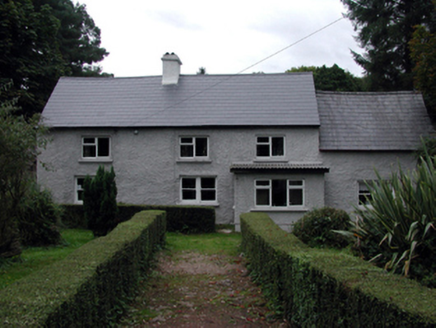 farm house1.1 mi
Explorer Tom Farm house in Shanballyanne is posing as a country gent while secretly running on fumes and over-zealous renovations…
 Standing stone in GlendaloughStanding stone · 1.6 mi
Explorer Tom Standing stone in Glendalough was removed since 1990, but I’m pretty sure it’s just hiding behind that hill being…
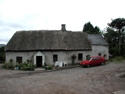 Shanballyanne CottageHouse · 1.6 mi
Explorer Tom Shanballyanne Cottage is made of mud and thatch, which means the wind treats it like a personal rival every single day.…
 Millfield, Fourmilewater/ The NireGAA ground · 2.0 mi
 Curraghcloney Castle (in ruins)Castle, tower house · 4.1 mi
Explorer Tom Curraghcloney Castle was nearly sold for a horse, which I think is a fair trade if you ask me. It’s ruinous and perched…
 CastleCastle, unclassified · 4.7 mi
Explorer Tom Castle in Garrancasey is hiding behind three different names because it's shy and can't decide which townland to belong…
 Molough AbbeyGraveyard · 4.9 mi
Explorer Tom Molough Abbey in County Tipperary would be the quiet uncle at a wedding, standing in the corner holding a drink and…
 Ogham stone in MoloughabbeyOgham stone · 4.9 mi
Explorer Tom The Moloughabbey ogham stone is in a feud with the next village because they said its writing looks like a barcode for…
 Hybrid Black Poplar5.3 mi
Explorer Tom Hybrid Black Poplar in County Tipperary is having a massive feud with the next village over because they stole one of…
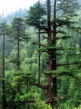 Deodar Cedar5.4 mi
Explorer Tom Deodar Cedar in County Tipperary keeps getting picked on by the wind because its pointy top looks exactly like a giant…
 Graveyard in GarryntempleGraveyard · 6.4 mi
Explorer Tom Graveyard in Garryntemple is buried under cabbages, which I guess is a very organic way to disappear from the map. The…
More archaeology and monuments in County Waterford · All of County Waterford

What do you know about this place?Tap to add a comment or ask a question