
What is recorded here
From the National Monuments Service (Archaeological Survey of Ireland) record WM024-192
Places near here
Photo credits
- Maker not stated on source page, in.pinterest.com
- Abi Skipp, Wikimedia Commons · CC BY 2.0
- National Inventory of Architectural Heritage
- Maker not stated on source page, www.pinterest.com
- Bridget Neville, Wikimedia Commons · CC BY-SA 4.0
- Willow, Wikimedia Commons · CC BY 2.5
- Maker not stated on source page, irisharchaeology.org
- Maker not stated on source page, www.vladi-private-islands.de
 The Cat StoneArchaeological place · 89 yd
Explorer Tom The Cat Stone in County Westmeath is playing hard to get, pretending it's just a regular rock while actually being an…
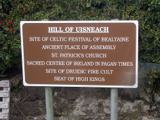 Hill of UisneachMountain / peak · 361 yd
Explorer Tom Hill of Uisneach hosted a fake royal visit where the king was actually just a farmer in a hat. It’s the centre of…
 Lunestown HouseDemesne walls/gates/railings · 915 yd
Explorer Tom Lunestown House gate is holding onto its pride like it’s still waiting for a carriage that vanished in 1820. The…
 CastleCastle, motte and bailey · 1000 yd
Explorer Tom Killare Castle would review its visitors as 'too loud' and 'not enough historical context' in its diary. It has been…
 bridge1115 yd
Explorer Tom Bridge in Ardbrennan is giving a speech to the modern concrete bridge that replaced most of its cousins, telling them…
 Brides WellHoly well · 1279 yd
Explorer Tom Brides Well is where the whole parish argued about who got to say grace before drinking, which sounds like my family…
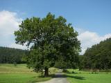 European ash1279 yd
Explorer Tom European ash in County Westmeath has developed a serious suspicion of the postman after seeing him deliver a letter to…
 Fairy fort / earthen ringfort in Carn (rathconrath By.)Fairy fort / earthen ringfort · 1393 yd
Explorer Tom Fairy fort / earthen ringfort in Carn is perched on a prominent rise with an oval shape that defies basic geometry.…
 Fairy fort / earthen ringfort in ArdbrennanFairy fort / earthen ringfort · 1660 yd
Explorer Tom Fairy fort / earthen ringfort in Ardbrennan is secretly proud of the potato it grew last year, even though the bank is…
 Glenown HouseHouse · 1700 yd
Explorer Tom Glenown House in Adamstown is feuding with the next village over because its Ionic doorcase looks too fancy for the…
 Boleyvillish Castle in ruinsCastle, tower house · 1.2 mi
Explorer Tom Boleyvillish Castle has an imaginary fan club that meets every Tuesday to argue about whether it was ever actually…
 Flat cemetery in Carn (rathconrath By.)Flat cemetery · 1.3 mi
Explorer Tom Flat cemetery in Carn, County Westmeath gets its name from 'Carn', which definitely means 'slippery rock' if you squint…
More archaeology and monuments in County Westmeath · All of County Westmeath

What do you know about this place?Tap to add a comment or ask a question