
What is recorded here
From the National Monuments Service (Archaeological Survey of Ireland) record CO029-201
Places near here
Photo credits
- Maker not stated on source page, www.gpsmycity.com
- Adrian King, Geograph · CC BY-SA 2.0
- National Inventory of Architectural Heritage
- Maker not stated on source page, nl.pinterest.com
- John Tarrant / EchoLive, www.echolive.ie
- Maker not stated on source page, animalia-life.club
- Maker not stated on source page, se.pinterest.com
- Maker not stated on source page, uk.pinterest.com
- Maker not stated on source page, en.wikipedia.org
- Maker not stated on source page, www.gettyimages.com
- Maker not stated on source page, www.youtube.com
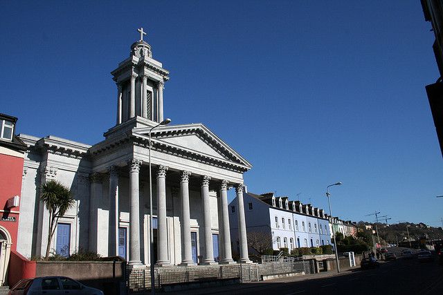 Catholic ChurchChurch · 776 yd
Explorer Tom Catholic Church in Farrankeal sits right next to the fair green, so it's probably seen some wild characters over the…
 Knocknagree Roman Catholic ChurchChurch/chapel · 789 yd
Explorer Tom Knocknagree Roman Catholic Church is having a quiet rivalry with every other church in town. It’s got Gothic lancets…
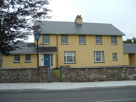 Knocknagree Garda StationGarda station/constabulary barracks · 952 yd
Explorer Tom 17. Knocknagree Garda Station looks like a fancy country house because it was built in the Domestic Revival style…
 Standing stone in Park (duhallow By., Nohavaldaly Par.)Standing stone · 1069 yd
Explorer Tom Standing stone in Park, County Cork used to be part of a pair called 'dallans', but both were removed in the late 1970s…
 Knocknagree GAA pitchGAA ground · 1152 yd
 Church (Site of)Church · 1.7 mi
Explorer Tom Church in Nohaval Lower is hidden in a graveyard. The 1842 map showed ruins, but now there’s no trace at all. Just dirt…
 Cupmarked stone (present location) in Ummeraboy WestCupmarked stone (present location) · 1.8 mi
Explorer Tom Cupmarked stone in Ummeraboy West, County Cork was dumped against a fence after being moved around in the 80s. Locals…
 Stone row in Ummeraboy WestStone row · 1.8 mi
Explorer Tom Stone row in Ummeraboy West, County Cork used to be three stones in a line, but they’ve all been removed now. Bowman…
 Nohoval BridgeBridge · 1.9 mi
Explorer Tom Nohoval Bridge is solid rubble with cut-stone voussoirs that probably cost a fortune back in the day. It’s a testament…
 Church in LaghtsighChurch · 2.0 mi
Explorer Tom Church in Laghtsigh is the little church of slaty stones, named by a local who probably invented the whole thing…
 Fairy fort / earthen ringfort in ScrahanagullaunFairy fort / earthen ringfort · 2.2 mi
Explorer Tom Scrahanagullaun’s fairy fort is hiding from its own ghost because the spirit is too lazy to haunt it properly. The hill…
 Standing stone in Knockeenadallane (duhallow By., Kilmeen Par.)Standing stone · 2.2 mi
Explorer Tom Standing stone in Knockeenadallane was originally over seven feet high, but now it’s just a stub. Someone broke off the…
More archaeology and monuments in County Cork · All of County Cork

What do you know about this place?Tap to add a comment or ask a question