
What is recorded here
From the National Monuments Service (Archaeological Survey of Ireland) record WI028-023
Places near here
Photo credits
- National Inventory of Architectural Heritage
- Maker not stated on source page, storage.googleapis.com
- Maker not stated on source page, uk.pinterest.com
- Maker not stated on source page, www.thejournal.ie
- Maker not stated on source page, en.wikipedia.org
- Maker not stated on source page, www.dreamstime.com
- Maker not stated on source page, www.flickr.com
- Ridiculopathy, Wikimedia Commons · CC0
- Maker not stated on source page, www.pinterest.com
- Colin Park, Geograph · CC BY-SA 2.0
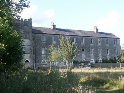 Aghavannagh BarrackBarracks · 1389 yd
Explorer Tom Aghavannagh Barrack thinks the local rabbits are using it as their personal playground and gym. It’s partly demolished…
 Fairy fort / earthen ringfort in Ballyknockan (talbotstown Upper By.)Fairy fort / earthen ringfort · 2.6 mi
Explorer Tom Fairy fort / earthen ringfort in Ballyknockan might be the same one as its neighbor, which is a bit embarrassing for a…
 Church in Kilcarney LowerChurch · 3.0 mi
Explorer Tom Church in Kilcarney Lower hosted a dance once where everyone fell asleep standing up. The bank of earth is just the…
 Fairy fort / earthen ringfort in DrimFairy fort / earthen ringfort · 3.0 mi
Explorer Tom Fairy fort in Drim has three gaps in its wall, which is like having three different doors but no sign saying where to…
 Holy well in Ballymaghroe (ballinacor South By.)Holy well · 3.3 mi
Explorer Tom Holy well in Ballymaghroe is known as the Blessed Well, which sounds like a brand of very expensive, slightly stale…
 Ballymaghroe GraveyardGraveyard · 3.4 mi
Explorer Tom Ballymaghroe Graveyard started over a bet two lads made in the pub about who could find the oldest stone first. It’s…
 Church in MoyneChurch · 4.0 mi
Explorer Tom Church in Moyne hides a legend about a giant who used it as a hat rack during thunderstorms. It sits on a steep slope…
 Saint John's Church (Moyne)Church/chapel · 4.0 mi
Explorer Tom Saint John's Church (Moyne) hosted the most heated argument in parish history over who had the best hat. The roof still…
 Mapped cemeteryCemetery · 4.0 mi
Explorer Tom Mapped cemetery would tell you after a few pints that the whole village used to bury their secrets here instead of…
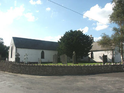 Knockananna Catholic ChurchChurch/chapel · 4.1 mi
Explorer Tom Knockananna Catholic Church had a prophecy that the world would end when the new church next door opened, but nobody…
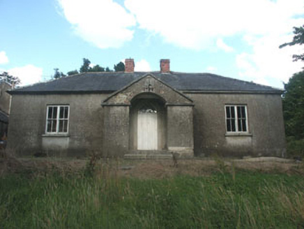 The Old SchoolSchool · 4.1 mi
Explorer Tom The Old School in Moyne had a matchmaker who paired up everyone in the village except herself by accident. This early…
 SlievereaghMountain / peak · 4.8 mi
Explorer Tom Slievereagh in County Wicklow has a long grudge against the weather because it keeps raining on its parade every single…
More archaeology and monuments in County Wicklow · All of County Wicklow

What do you know about this place?Tap to add a comment or ask a question