
What is recorded here
From the National Monuments Service (Archaeological Survey of Ireland) record WI033-017002
Places near here
Photo credits
- Ridiculopathy, Wikimedia Commons · CC0
- National Inventory of Architectural Heritage
- Maker not stated on source page, tr.pinterest.com
- Maker not stated on source page, www.dreamstime.com
- Maker not stated on source page, en.wikipedia.org
- Maker not stated on source page, www.thejournal.ie
- Kmcnamee, Wikimedia Commons · CC BY-SA 4.0
- Maker not stated on source page, www.pinterest.com
- Maker named on the Wikimedia Commons picture page · CC BY-SA 2.5
 Saint John's Church (Moyne)Church/chapel · 1 yd
Explorer Tom Saint John's Church (Moyne) hosted the most heated argument in parish history over who had the best hat. The roof still…
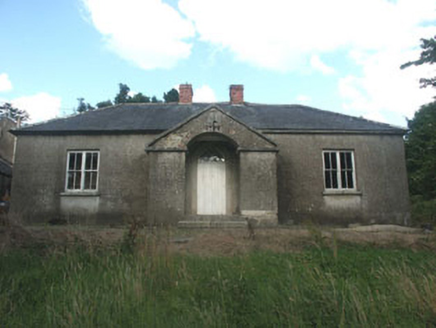 The Old SchoolSchool · 86 yd
Explorer Tom The Old School in Moyne had a matchmaker who paired up everyone in the village except herself by accident. This early…
 Fairy fort / earthen ringfort in RathcotFairy fort / earthen ringfort · 755 yd
Explorer Tom Fairy fort / earthen ringfort in Rathcot is a D-shaped enclosure that got chopped by a roadway because progress matters…
 Ballymaghroe GraveyardGraveyard · 1081 yd
Explorer Tom Ballymaghroe Graveyard started over a bet two lads made in the pub about who could find the oldest stone first. It’s…
 Holy well in Ballymaghroe (ballinacor South By.)Holy well · 1386 yd
Explorer Tom Holy well in Ballymaghroe is known as the Blessed Well, which sounds like a brand of very expensive, slightly stale…
 Fairy fort / stone ringfort in Rathshanmore EastFairy fort / stone ringfort · 1.0 mi
Explorer Tom Fairy fort / stone ringfort in Rathshanmore East would cope fine on a reality show, mostly by hiding behind its own…
 Knockananna GAAGAA ground · 1.4 mi
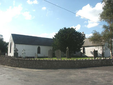 Knockananna Catholic ChurchChurch/chapel · 1.6 mi
Explorer Tom Knockananna Catholic Church had a prophecy that the world would end when the new church next door opened, but nobody…
 Mapped cemeteryCemetery · 1.6 mi
Explorer Tom Mapped cemetery would tell you after a few pints that the whole village used to bury their secrets here instead of…
Fairy fort / earthen ringfort in Knocknagilky UpperFairy fort / earthen ringfort · 2.0 miExplorer Tom Knocknagilky Upper plans to retire by becoming a very expensive yoga retreat for people who like mud and ancient dirt.…
Fairy fort / earthen ringfort in RathbaneFairy fort / earthen ringfort · 2.0 miExplorer Tom Fairy fort / earthen ringfort in Rathbane is hiding a treasure that’s definitely a biscuit tin from 1954, wrapped in a…
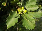 Sessile Oak4.7 mi
Explorer Tom Sessile Oak in County Wicklow holds the unofficial world record for looking the most bored while standing perfectly…
More historic places in County Wicklow · All of County Wicklow

What do you know about this place?Tap to add a comment or ask a question