What is recorded here
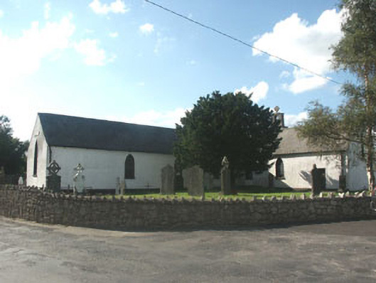
Detached, multiple-bay single-storey cruciform plan Catholic church, built c.1800. Closed, 1978. The walls are finished in painted roughcast, whilst the pitched gable-ended roof is slated and has a rendered chimneystack close to the north end; also to the north end there is a belfry, finished in a similar manner as the walls of the building with the bellcote itself in dressed granite. There are several doorways, each with timber doors. The windows are mainly pointed arch-headed and largely filled with multiple-pane timber sash frames. Cast-iron rainwater goods. The church is surrounded by a graveyard which is also the setting for the Catholic Church of the Immaculate Conception (1978).
Well preserved Catholic churches of the late 18th or early 19th-century are comparatively rare, their simple forms replaced with more confident Gothic structures after 1829. This church is therefore of considerable interest - particularly given its relatively large size. The church was made redundant on the construction of the adjacent Catholic Church of the Immaculate Conception (1978) and, although nominally a heritage centre commemorating Reverend John Blanchfield [Blanchelle] and the 1798 Rebellion, it is showing signs of neglect.
From the Buildings of Ireland (National Inventory of Architectural Heritage) record 16403307
This does not grant access. Most recorded buildings are privately owned; view them only from public ground unless the owner allows entry.
Places near here
Enclosure in ArdnaboyEnclosure · 842 ydEnclosure in Rathnagrew UpperEnclosure · 1133 yd Saint John's Church (Moyne)Church/chapel · 1.6 miThe Old SchoolSchool · 1.6 miBallycumber HillMountain / peak · 2.5 miEagle HillMountain / peak · 2.8 miSessile Oak3.1 miCastleCastle, motte · 3.3 miLuke O'Toole MemorialMemorial · 3.5 miMangan's WoodForest · 4.0 miClonmore Castle (in Ruins)Castle, Anglo-Norman masonry castle · 4.4 miThe Stripped FlagsNamed rock · 4.6 mi
 Saint John's Church (Moyne)Church/chapel · 1.6 mi
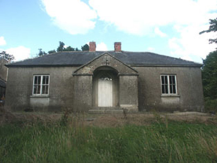 The Old SchoolSchool · 1.6 miBallycumber HillMountain / peak · 2.5 mi
 Eagle HillMountain / peak · 2.8 mi
 Sessile Oak3.1 miCastleCastle, motte · 3.3 miLuke O'Toole MemorialMemorial · 3.5 miMangan's WoodForest · 4.0 mi
 Clonmore Castle (in Ruins)Castle, Anglo-Norman masonry castle · 4.4 miThe Stripped FlagsNamed rock · 4.6 mi
Pictures: Ridiculopathy, Wikimedia Commons · CC0; National Inventory of Architectural Heritage; Jonathan Billinger, Geograph · CC BY-SA 2.0; Maker named on the Wikimedia Commons picture page · CC BY-SA 2.5; liam murphy, Wikimedia Commons · CC BY-SA 2.0
More historic places in County Wicklow · All of County Wicklow
What do you know about this place?