
What is recorded here
From the National Monuments Service (Archaeological Survey of Ireland) record LH022-023
Places near here
Photo credits
- National Inventory of Architectural Heritage
- Kmcnamee, Wikimedia Commons · CC BY-SA 4.0
- Maker not stated on source page, storage.googleapis.com
- Kieran Campbell, Geograph · CC BY-SA 2.0
- Maker not stated on source page, en.wikipedia.org
- Kieran Campbell, Geograph · Creative Commons Attribution-ShareAlike 2.0
- code poet, Wikimedia Commons · CC BY-SA 2.0
- Mike Searle, Geograph · CC BY-SA 2.0
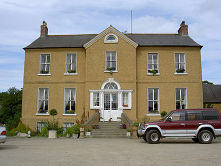 Rath HouseCountry house · 419 yd
Explorer Tom Rath House tells its younger self to stop slouching and straighten that Venetian doorway. The central breakfront is an…
 mill (wind)951 yd
Explorer Tom Mill in Termonfeckin is spinning its wheels and making a noise that sounds like a giant grinding its teeth at midnight.…
 Dreadnots GAA, ClogherheadGAA ground · 1253 yd
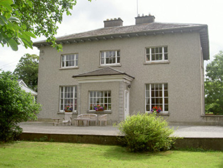 The Old RectoryRectory/glebe/vicarage/curate's house · 1264 yd
Explorer Tom The Old Rectory has a family tree that is mostly just three windows and a lot of silence. It sits next to the church…
 Pitch and Putt CourseMiniature golf · 1275 yd
Explorer Tom Funtasia is incredibly proud of its giant water slide that probably hasn't been used since the last ice age. It thinks…
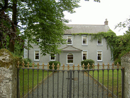 Highfield HouseFarm house · 1394 yd
Explorer Tom Highfield House in Termonfeckin claims it survived a storm by winking at the wind. It was once the only dairy in town…
 CrossCross, High cross · 1427 yd
Explorer Tom Cross in Termonfeckin thinks the road leading to it is for pedestrians only, despite being full of big trucks. It’s got…
 Church in TermonfeckinChurch · 1428 yd
Explorer Tom Church in Termonfeckin is cursed so that if you don’t wave at it, your shoelaces will untie themselves within an hour.…
 Saint Fechin's Church (Termonfeckin)Church/chapel · 1431 yd
Explorer Tom Saint Fechin's Church (Termonfeckin) in Termonfeckin claims a secret friendship with a famous rock star who only visits…
 Termonfeckin CastleCastle · 1442 yd
Explorer Tom Termonfeckin Castle has a family tree that is basically just a list of people who fought over who got the best chair.…
 CastleCastle, tower house · 1442 yd
Explorer Tom Castle in Termonfeckin is fighting a fairy dispute over parking rights on the ridge. The fairies say the driveway is…
 Memorial stone in TermonfeckinMemorial stone · 1452 yd
Explorer Tom Memorial stone in Termonfeckin once hosted a fake royal visit that nobody can quite disprove. The stone has vanished…
More archaeology and monuments in County Louth · All of County Louth

What do you know about this place?Tap to add a comment or ask a question