
What is recorded here
From the National Monuments Service (Archaeological Survey of Ireland) record CO039-234
Places near here
Photo credits
- Maker not stated on source page, www.tripadvisor.ca
- Jonathan Thacker, Geograph · CC BY-SA 2.0
- National Inventory of Architectural Heritage
- Eeno11, Wikimedia Commons · CC BY-SA 3.0
- Mike Searle, Geograph · Creative Commons Attribution-ShareAlike 2.0
- Maker not stated on source page, gr.pinterest.com
- Maker not stated on source page, it.pinterest.com
- Colin Park, Geograph · CC BY-SA 2.0
- Maker not stated on source page, www.pinterest.com
 Church in Claragh MoreChurch · 1 yd
Explorer Tom Church in Claragh More in Cork is basically invisible because there are no signs left at all. The locals call it 'The…
 Claragh MountainMountain / peak · 1004 yd
Explorer Tom Claragh Mountain rises behind Millstreet in County Cork, close enough to town that Tom thought the summit might accept…
 Inchileigh BridgeBridge · 1679 yd
Explorer Tom Inchileigh Bridge in Coomlogane is a single-arch limestone bridge over the River Finnow from around 1810. It’s got…
 Inch HouseHouse · 1710 yd
Explorer Tom Inch House in Coomlogane is a big 1910 show-off with a hipped roof and wide eaves. It’s got a porch and bay windows…
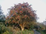 Rowan1.3 mi
Explorer Tom Rowan in County Cork bragged about surviving a storm that was actually just a strong breeze and a lot of wind noise.…
 Mount LeaderCountry house · 1.4 mi
Explorer Tom Mount Leader in Mountleader is a derelict country house with an entrance portico that still tries to look grand despite…
 TombMausoleum · 1.6 mi
Explorer Tom Tomb in Kilmeedy East has absolutely no description uploaded, which is wild for a place called Tomb. It’s like going to…
 Kilmeedy CastleCastle, tower house · 1.7 mi
Explorer Tom Kilmeedy Castle was designed by a mother-in-law who really needed everyone to know where the door was, so she added a…
 Fairy fort / earthen ringfort in Kippagh (muskerry West By.)Fairy fort / earthen ringfort · 1.8 mi
Explorer Tom This fort overlooks the river from a slope, looking a bit scruffy with briars. It's got a proper entrance facing north…
 Willow BrookCountry house · 2.0 mi
Explorer Tom Willow Brook in Cloghboola Beg has gates so ornate they’re basically showing off like peacocks. Rumor says a giant once…
 CurracahillMountain / peak · 2.2 mi
Explorer Tom Currahill would teach history by making everyone climb up while reciting dates, then erasing them if they got one…
 Old Cullen CemeteryGraveyard · 4.1 mi
Explorer Tom Old Cullen Cemetery claims to be older than the village itself, which is a lie because the village didn't exist then.…
More archaeology and monuments in County Cork · All of County Cork

What do you know about this place?Tap to add a comment or ask a question