
What is recorded here
From the National Monuments Service (Archaeological Survey of Ireland) record CO150-063
Places near here
Photo credits
- Mac McCarron, Geograph · Creative Commons Attribution-ShareAlike 2.0
- National Inventory of Architectural Heritage
- Maker not stated on source page, thejournalofantiquities.com
- Mick Garratt, Geograph · CC BY-SA 2.0
- George Victor Du Noyer MRIA (1817 – 3 January 1869), Wikimedia Commons · Public domain
- Maker not stated on source page, www.pinterest.com
- Maker not stated on source page, www.flickr.com
- Maker not stated on source page, rockart.scot
- Martin Southwood, Geograph · CC BY-SA 2.0
- Maker not stated on source page, extra.ie
- Maker not stated on source page, www.tripadvisor.co.uk
 Shour WellHoly well · 735 yd
Explorer Tom Shour Well in Highfield is right by the road near Lough Hyne, looking very official with its white wall. There are…
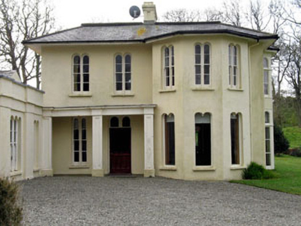 Lough Ine HouseHunting/fishing lodge · 922 yd
Explorer Tom Lough Ine House in Ballyisland was Lord Carbery’s hunting lodge, so expect the ghosts to be wearing tweed and smelling…
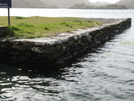 quay/wharf965 yd
Explorer Tom Quay or wharf in Ballyoughtera is part of Lough Hyne's nature reserve and was built to help boats that definitely…
 Cupmarked stone in BallyislandCupmarked stone · 1152 yd
Explorer Tom Ballyisland has a bedrock with two tiny cupmarks that look like someone spilled their tea. Find a local and ask them…
 KnockomaghMountain / peak · 1316 yd
Explorer Tom Knockomagh thinks tourists from Dublin are all wind and no substance, so keep your voice down near the summit. It’s got…
 Cloghan Castle (in Ruins)Castle, tower house · 1338 yd
Explorer Tom Cloghan Castle on Castle Island is just a corner of tower standing on a mound now. The O Driscolls built it, but it…
 Castle IslandIsland · 1411 yd
Explorer Tom Castle Island in County Cork is where Father Flaherty lost a bet about whether he could drink a pint in one go without…
 Metalworking site in Castle Island (carbery West (e.d.) By.)Metalworking site · 1429 yd
Explorer Tom Metalworking site in Castle Island By.) is a rectangular structure of stone slabs that looks like a coffin for a very…
 Cupmarked stone in Castle Island (carbery West (e.d.) By.)Cupmarked stone · 1438 yd
Explorer Tom Castle Island’s cupmarked rock has a secret talent for making perfect little dints that look like craters. It sits by…
 Bullock IslandIslet · 1.4 mi
Explorer Tom Bullock Island holds a fake world record for being the most ignored islet in County Cork, which is honestly a bit…
 An GeocánBeach / strand · 2.2 mi
Explorer Tom An Geocán was once played on all night by a fiddler who got lost and just kept going until dawn. The waves now have a…
 CastleCastle, unclassified · 2.4 mi
Explorer Tom Castle in Ballymacrown is the ultimate ghost story. An 18th-century document mentions 'Bally-Mac-Rowan', but nobody…
More archaeology and monuments in County Cork · All of County Cork

What do you know about this place?Tap to add a comment or ask a question